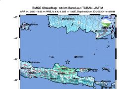
Head of Matarams Meteorology, Climatology and Geophysics Agency (BMKG) Agus Riyanto said the earthquake was located at the coordinate of 8.88 degrees southern latitude and -115.24 degrees easten longitude at a depth of 117 km.
With strong, moderate and weak tremors, the earthquake was felt in a number of regions in the tourist resort province of Bali such as Kuta, Gianyar and Denpasar.
The tremors were also felt in the islands of Lombok and Sumbawa of the NTB province with an intensity scale of III-V modified mercalli intensity (MMI). In these areas almost all felt the tremors.
"The tremors of the earthquake were also reportedly felt in Banyuwangi, East Java," Riyanto said.
Seeing the depth of its epicenter, the earthquakes scale is categorically medium. It is triggered by a subduction as a result of the interaction of the Indo-Australia and Eurasia plates.
An earthquake measuring five on the Richter scale is capable of causing considerable damage and one measuring six severe damage.
"Up to this report is filed, there are no immediate reports on aftershocks and damage or losses incurred by earthquake," he said.
The BMKG official called on residents to remain calm and follow the directives of the regional Natural Disaster Mitigation Agencies (BPDB) and the BMKG.
(A014)
Editor: Jafar M Sidik
Copyright © ANTARA 2017
