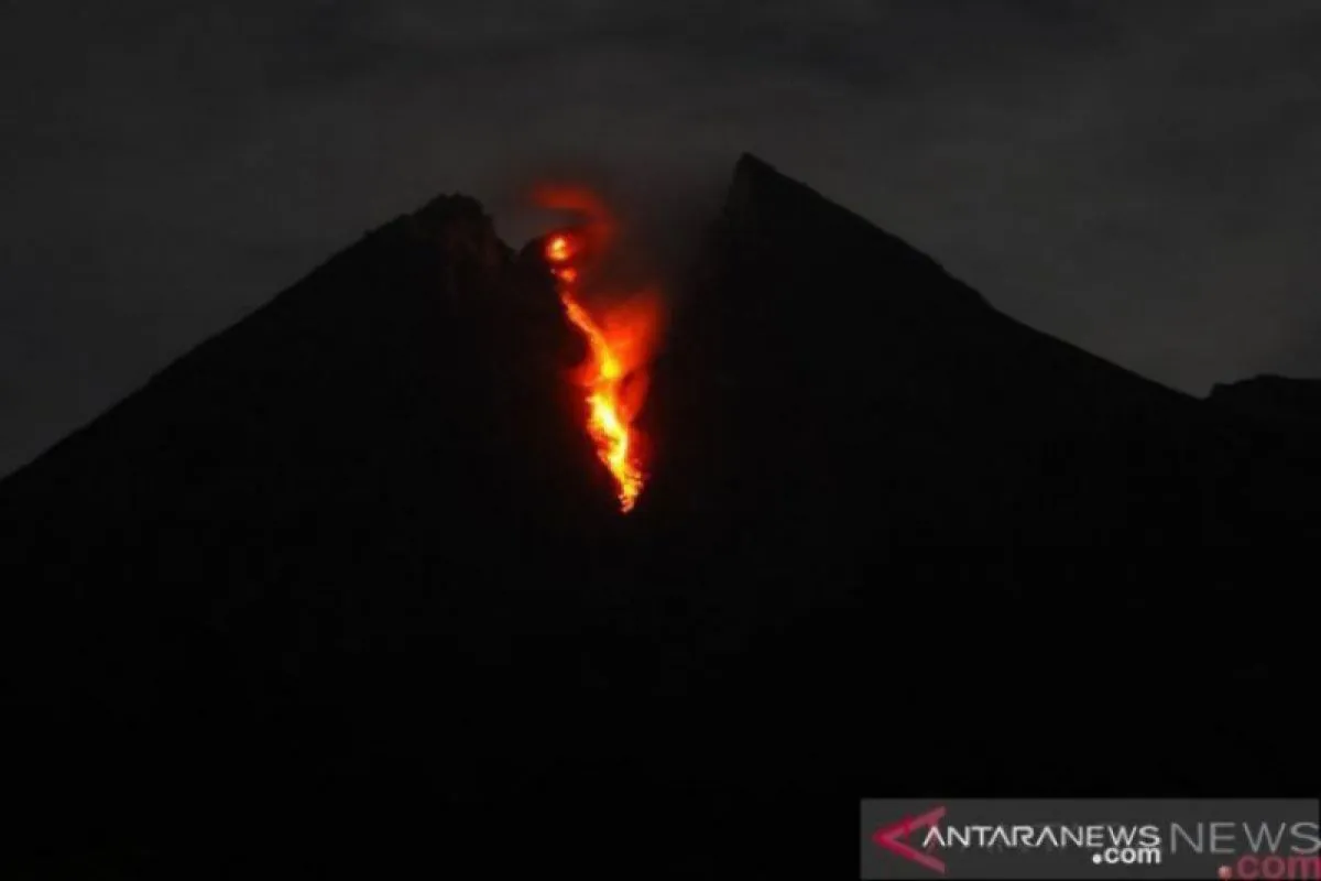
BPPTKG Head Hanik Humaida noted in his official statement in Yogyakarta on Friday that the CCTV monitoring of lava avalanches between 00:00 and 6:00 WIB indicated the lava flowing upstream of Gendol River.
Moreover, the BPPTKG reported four earthquakes of amplitudes between three and 36 mm lasting for 24-87 seconds, one low-frequency earthquake of 4-mm amplitude for 15 seconds, and two multi-phase earthquakes of 2-20 mm amplitude for a duration of 5-17 seconds.
According to visual observations, smoke from the crater was visibly white and of thin to moderate intensity and rose 30 meters above the crater's peak.
Weak to moderate winds blew over the mountain to the south, southwest, and west. Air temperatures of 14.5-19.3 degrees Celsius; air humidity, 58-97 percent; and air pressure of 567.7-708 mmHg were recorded.
The BPPTKG has, until now, not changed the status of Mount Merapi, maintaining it at Level II, or Alert, and in the interim, has advised against conducting climbing activities apart from those for disaster mitigation-related investigation and research.
The BPPTKG has called on residents to not conduct activities within a three-kilometer radius of Mount Merapi's summit.
The BPPTKG has appealed to those residing around the Gendol River to step up vigil over the extent to which the hot clouds from Merapi will dissipate.
Moreover, the community was urged to not be incited by issues pertaining to Mount Merapi's eruption, whose sources remain unclear, and continue to follow the directions of local government officials or directly channel their queries to the Observation Post of Mount Merapi or the BPPTKG office, or through the social media platform of BPPTKG.
EDITED BY INE
Translator: Eliswan Azly
Editor: Sri Haryati
Copyright © ANTARA 2019


