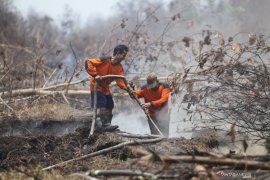
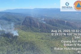
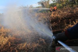
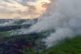
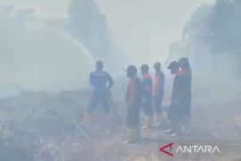
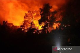
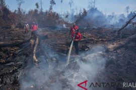
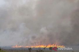
The fires caused by the current drought have burnt 1.8 million hectares of land and forest areas, most of which are peatland forests.Jakarta (ANTARA News) - Peatland fires have been one of the contributing factors to the deteriorating haze, which has blanketed several parts of Indonesia in the past couple of months.
According to Coordinating Minister for Political, Legal and Security Affairs Luhut Binsar Panjaitan, the fires caused by the current drought have burnt 1.8 million hectares of land and forest areas, most of which are peatland forests.
The difficulties encountered in containing peatland fires are the depth of the peat and the amount of water needed to extinguish them. The deeper the peat, greater the difficulty faced in putting out the fires.
It is believed that 70 percent of the peatland fires in Sumatra and Kalimantan reached a depth of three meters.
To minimize the occurrence of forest and land fires in the islands, irrigation expert from the Bogor Institute of Agriculture (IPB) Prof. Budi Indra Setiawan has suggested that the government should classify areas as peatlands.
According to Setiawan, the effective management of peatland areas can minimize forest fires. The management should be conducted properly as the ability of peatland areas to store and stream water is different from other areas.
Peatlands are formed when waterlogging delays the decay of organic matter, mostly vegetation, and collects over the course of thousands of years.
The ability of peatlands to store water is very low, while their ability to stream water is comparatively high.
"As a result, peatland areas cannot store water maximally," he pointed out.
During an inspection of the firefighting efforts in Sumatras province of Riau, President Joko Widodo admitted that peatland fires are the most difficult to extinguish as they continue to burn below the surface although they might appear to have been put out. So, partitioned canals and water reservoirs are the most effective systems to prevent peatland fires.
The president emphasized that efforts to prevent fires in the future must be the main focus, including anticipatory measures in the form of development of canals and water reservoirs.
He further stated that the development of canals and water reservoirs had already started in the provinces of Central Kalimantan and Riau.
Especially in Riau, water pools have been created in the areas formerly affected by fires in the village of Rimbo Panjang by involving three units of heavy equipment and personnel from the armys strategic reserve command (Kostrad), Manggala Agni, and Satpol PP (public order officers). The pool in Rimbo Panjang village can accommodate 800 to one thousand cubic feet of water.
In response to the peatland fires, the Geospatial Information Agency (BIG) will map out areas around peatlands, with good water infiltration, to facilitate fire prevention in future.
"In an effort to prevent fires, the Ministry of Environment and Forestry will demarcate peat hydrological zones. We are going to map out areas around peatlands, with good catchment areas, to be protected," Deputy for Thematic Geospatial Information Nur Wadjedi remarked on Friday (Oct. 9).
Indonesias peatlands cover an area of over 15 million hectares, most of which have been exploited.
"The land areas that have been affected by the fires should be protected from being burnt again, while the unaffected areas must be protected," he affirmed.
Official measures to simultaneously combat forest and land fires have mitigated the impacts of climate change and can actually be implemented by issuing a moratorium. The BIG has prepared various thematic maps to support climate change mitigation efforts, he noted.
The areas to be mapped out are dynamic, covering moratorium areas, natural forests, conservation areas, and national peatland areas.
He emphasized that mapping and monitoring activities, which are conducted biennially, will furnish information on the developments in moratorium areas.
After realizing that most of the land fires are found in peatland areas, the government plans to stop issuing permits to any business undertakings to run plantations and timber estates on them.
The government will also evaluate the existing permits issued to plantation and timber estate companies to manage nearly 4.8 million hectares of peatlands and reprimand regional governments found recklessly issuing peatland-related permits.
Panjaitan stated that the government will take over the land from plantation and timber estate companies found guilty of letting fires burn their land areas.
"The companies must protect their land. It is impossible for us to be constantly preoccupied with tasks to put out their burnt land every dry season," he said after inspecting the handling of haze disaster in Palembang, South Sumatra, on October 9.
According to Panjaitan, plantation and timber estate companies must set up firefighting units or divisions to protect their land and workplace from fires.
The government with take over the land of companies who fail to set up firefighting units or divisions by next year.
By taking anticipatory measures and making the required preparations, haze disaster during the dry season, which normally lasts from April to October, could hopefully be avoided, he noted.(*)
Reporter: Suharto
Editor: Heru Purwanto
Copyright © ANTARA 2015
