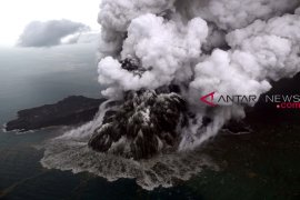
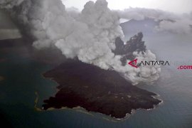
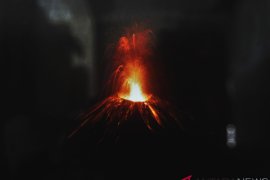
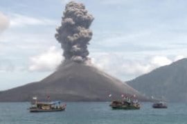
The agency`s seismograph censors had continuously recorded volcanic activities of Mount Anak Krakatau, Rahmat Triyono, head of the earthquake and tsunami center of the BMKG, noted at a press conference here, Tuesday evening.
The agency has installed six seismograph censors around the erupting volcano located in the Sunda Strait, between Java and Sumatra Islands.
On December 22, the agency recorded a 3.4-magnitude landslide event from Mount Anak Krakatau.
Meanwhile, the BMKG had earlier noted that the tsunami that struck in Sunda Strait on Saturday (Dec 22) was caused by an avalanche on the slopes of Mount Anak Krakatau.
"From the observation of satellite imagery, deformation was observed on 64 hectares of Mt Anak Krakatau, especially on the southwest slope," BMKG Head Dwikorita Karnawati noted in a statement in Jakarta on Monday.
Deformation or change in shape on the surface of the body of Mt Anak Krakatau emerged after part of its surface collapsed.
The tsunami had hit five districts in the provinces of Lampung and Banten without early warning, as it was caused by the volcanic eruption, while usually a tsunami in Indonesia was triggered by an earthquake.
The National Disaster Mitigation Agency, or BNPB, earlier stated that the death toll from the tsunami triggered by Mount Krakatau`s eruption, reached 492 people.
The natural disaster also injured 1,485 people, rendered 154 others missing, and displaced 16,082 people.
The eruption of Krakatoa, or Krakatau, in August 1883 was one of the most deadly volcanic eruptions in modern history. It is estimated that more than 36 thousand people had died.
Reporting by Benardy F, Fardah
Editing by sri Haryati
Reporter: Antara
Editor: Fardah Assegaf
Copyright © ANTARA 2018

