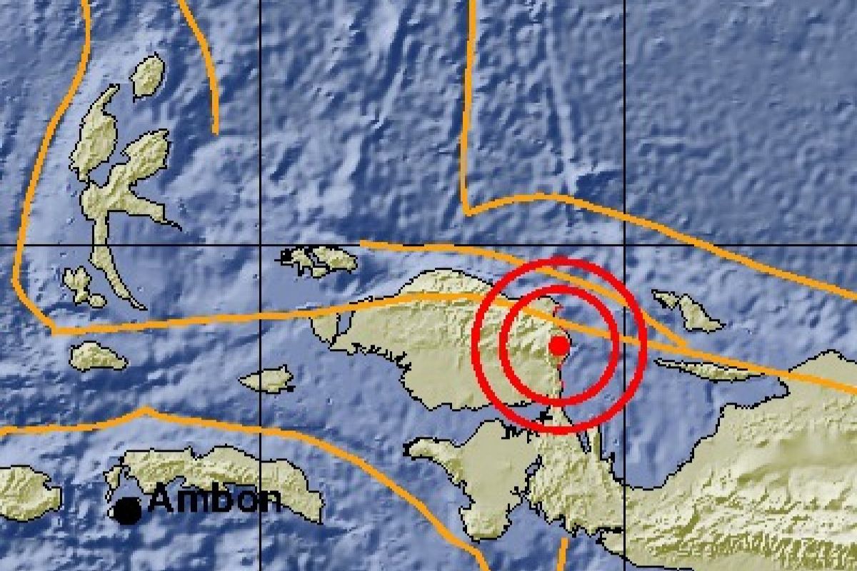
Denny Puttiray, the head of Manokwari Meteorology and Geophysics Agency (BMKG), remarked here on Friday that epicenter of the earthquake that struck three minutes after noon East Indonesia Standard Time (WIT) was located at 1.40 degrees south latitude and 134.10 degrees east longitude, at a depth of 26 kilometers (km), or some 55 km southeast of South Manokwari.
He said the earthquake was felt strongly by the people in Manokwari and South Manokwari, triggering panic.
In the meantime, Budi Setiawan, a resident of Oransbari in South Manokwari, noted that the shock was felt in Oransbari, as aftershocks occurred several times in the area.
"Many residents on the beach are monitoring the sea waves for fear of an ensuing tsunami," Setiawan noted.
Manokwari Police Chief Adjunct Senior Commissioner Adam Erwindi noted on a separate occasion that his side was identifying the impact of the earthquake.
"Especially in the South Manokwari District area, such as Ransiki and its surroundings, as the epicenter of the earthquake is near there. Hopefully, there would be no damage," Erwindi added.
Reporting by Toyiban
Editing by Otniel Tamindael, Bustanuddin
Reporter: antara
Editor: Heru Purwanto
Copyright © ANTARA 2018
