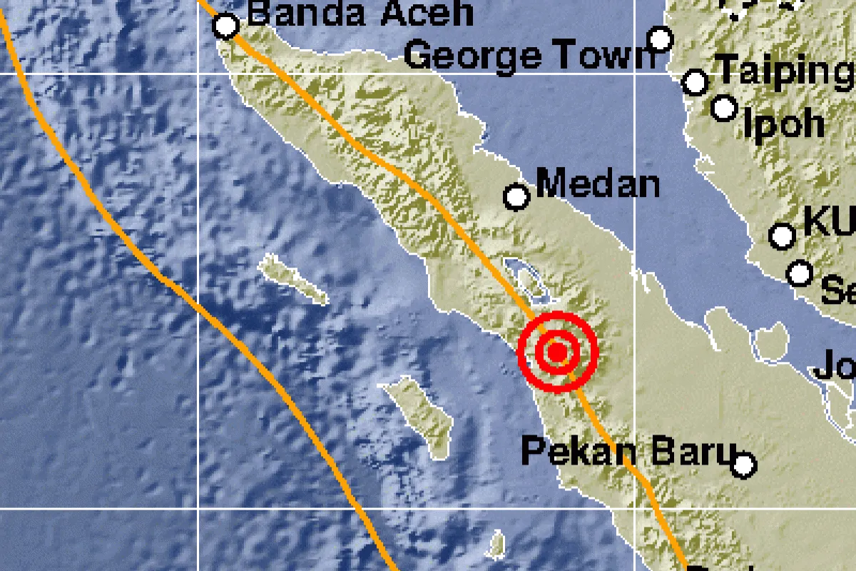
The quake`s epicenter was located at 1.77 degree northern latitude and 99.09 degree eastern longitude, 31 km southeast of North Tarutung, and at a depth of 10 km, the Meteorology, Climatology and Geophysics Agency (BMKG) said on its website, Tuesday.
The tremor was a shallow crustal earthquake triggered by activities of Sumatra fault zone in its Toru segment.
The earthquake was felt by residents of Tarutung and Sipahutar at IV MMI (modified mercalli intensity), and of Porsea at II-III MMI.
Many local residents were panic-stricken when the quake occurred, and they rushed out of their homes.
The tremor did not have potential to trigger a subsequent tsunami.
Indonesia is one of the most disaster-prone countries in the world, as it is located on the "Pacific Ring of Fire" where a large number of volcanoes and earthquakes occur.
During the January-December 2018 period, at least 2,427 natural disasters hit Indonesia, leaving 4,821 people dead or missing, according to the National Disaster Mitigation Board (BNPB).
The natural disasters also led to injuries to at least 8,400 people, displaced nearly 10 million others, and damaged some 400 thousand houses last year.
Reporting by Juraidi, Fardah A
Reporter: Antara
Editor: Sri Haryati
Copyright © ANTARA 2019