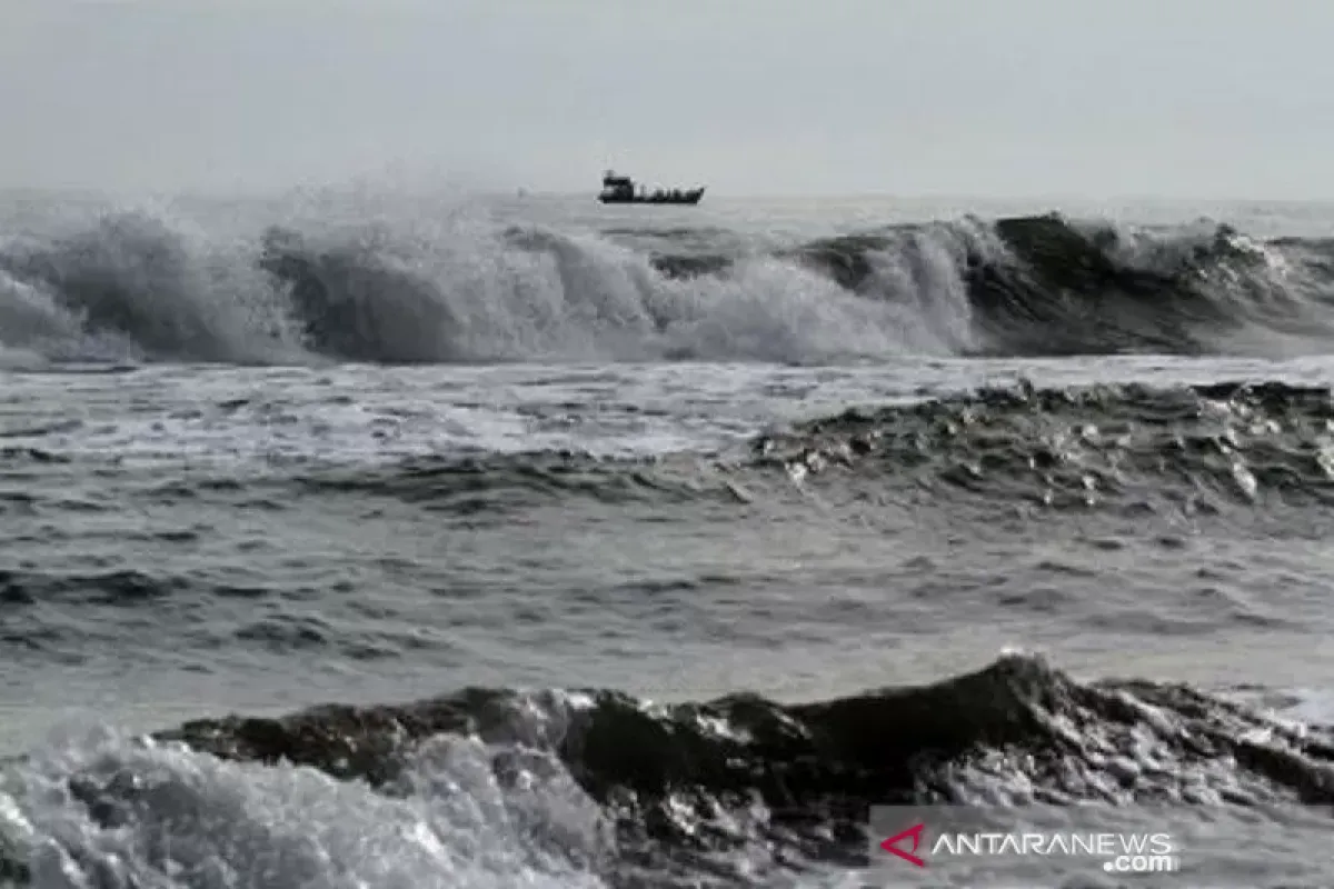
"Extreme waves reaching heights of more than six meters are likely to arise in the Indian Ocean west of Bengkulu - Lampung and the Indian Ocean south of Banten - Bali," Head of the BMKG Maritime Meteorology Center Eko Prasetyo noted in a statement received here on Thursday.
Prasetyo remarked that the high waves were influenced by winds in the northern part of Indonesia, which dominantly moved from southeast to southwest at speeds of 5-25 knots. Meanwhile, in the southern part of Indonesia, the wind movement was more dominantly from east to southeast at speeds of 5-25 knots. The highest wind speeds were observed in the waters north of Sabang, the waters of Banten - south of East Java, the Java Sea, the Banda Sea, and the Arafuru Sea.
This condition results in increasingly high waves reaching 1.25 - 2.50 meters to likely occur in several waters in the northern Malacca Strait, the eastern waters of Mentawai Islands, the waters of Bintan - Lingga Islands, Natuna Sea, Karimata Strait, Bangka Belitung waters, Gelasa Strait, the waters in southern Kalimantan, west and central Java Sea, northern waters of West Java - East Java, southern Makassar Strait, Sulawesi Sea, Tomini Bay, northern Lombok Strait, Bali Sea - Sumbawa Sea - Flores Sea, northern waters of Flores, Ombai Strait, waters Selayar Islands - Sabalana Islands, Bone Bay, Baubau waters - Wakatobi Islands, Manui - Kendari waters, Tolo Bay, southern waters of the Banggai Islands - Sula Islands, Buru Island waters - Ambon Island - Seram Island, Seram Sea, Sermata Islands waters - Babar Islands, the waters of Fakfak - Kaimana, the waters of Agats - Amamapere, the waters of Yos Sudarso, the waters of Sarmi - Jayapura, and the Pacific Ocean north of Jayapura.
Moreover, higher waves reaching heights of 2.50 - 4.0 meters are likely to occur in the eastern waters of Simeulue Island - Nias Islands, eastern Java Sea, Sumba Strait and southern Sape Strait, northern Sawu Sea, Kupang waters - Rotte Island, Banda Sea, the waters of the Tanimbar Islands - Kei Islands - Aru Islands and the Arafuru Sea.
Meanwhile, higher waves of between four to six meters are likely to occur in the waters north of Sabang, waters west of Aceh - Mentawai Islands, waters of Bengkulu - west of Lampung, Indian Ocean west of Aceh - Mentawai Islands, western and southern Sunda Strait, the southern waters of Banten - Sumba Island, the Bali Strait - Lombok - southern Alas, the waters of Sawu Island, the southern part of Sawu Sea, and the Indian Ocean in the south of West Nusa Tenggara - East Nusa Tenggara.
"The potential for high waves in some of these areas can pose a risk to shipping safety," Prasetyo remarked.
To this end, the BMKG has always appealed to the public to stay vigilant, especially applicable to fishermen actively operating their fishing boats at speeds of more than 15 knots.
Moreover, fishermen using barges at speed of over 16 knots, ferries with speed of more than 21 knots, and large vessels, such as cargo ships and cruise ships, with speed crossing 27 knots also need to exercise caution.
"We urge people living and working in coastal areas, where high waves are likely to occur, to stay alert," Prasetyo emphasized.
Related news: BMKG warns pressing need for authorities to mitigate climate change
Related news: Do not underestimate BMKG's disaster warnings: minister
Related news: Jokowi urges BMKG to increase disaster mitigation, management capacity
Translator: Devi Nindy Sari Ramadhan, Katr
Editor: Sri Haryati
Copyright © ANTARA 2021


