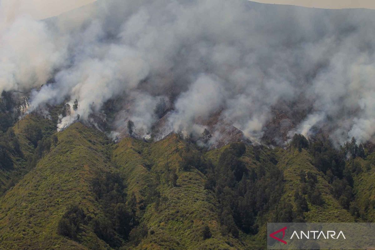
"Access to the burning sites is difficult, (as the terrain is) hilly and steep," the ministry's director of forest and land fire control, Thomas Nifinluri, said here on Monday.
According to him, the fire has been blazing for five days and is becoming increasingly widespread.
He said the difficult terrain is limiting the progress of the firefighting team, in addition to strong winds that are feeding the fire.
The Bromo Tengger Semeru National Park Agency has been forced to close all access to the Mount Bromo tourist area to ease fire-fighting operations.
"The closure is effective from Sunday, September 10, 2023, starting at 7 p.m. local time, until an undetermined date," Nifinluri informed.
Based on information provided by the Regional Disaster Mitigation Agency (BPBD), the area of forest and land burned in the fire on Mt. Bromo has reached 274 hectares.
Nifinluri said the government will calculate the burned area by using satellite imagery.
The fire handling is being carried out with the East Java provincial and Malang task force teams, volunteers, the fire awareness community, and the Bromo Tengger Semeru National Park Agency's fire-handling team.
On the second day of the fire handling operation, a team was deployed to conduct water bombing from the air with the support of the National Disaster Mitigation Agency (BNPB).
Meanwhile, the national park agency has closed four entrances to the national park area due to the forest and land fire.
All entrances, Coban Trisula in Malang, Wonokitri in Pasuruan, Cemorolawang in Probolinggo, and Senduro in Lumajang, have been closed as of Monday.
The agency has asked people traveling on the Malang-Lumajang route via Poncokusumo and Senduro to find alternative routes.
Related news: Mt Bromo, Mt Semeru reopen to climbers, tourists
Translator: Sugiharto P, Kenzu
Editor: Azis Kurmala
Copyright © ANTARA 2023
