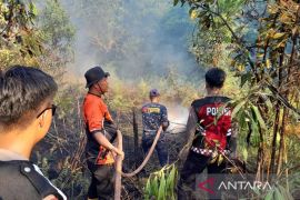
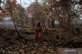
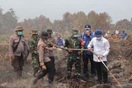
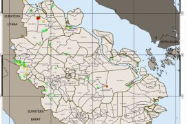
"There are seven hotspots in Sumatra, and all of them are in Riau, namely five in Rokan Hilir District, and two in Bengkalis, Sanya Gautami, a Riau BMKG analyst, said here Saturday.
The number of hotspots had dropped significantly from a few days ago when 36 - 56 hotspots were detected in Sumatra, mostly in Riau island, he said.
The hotspots were previously not detected due to clouds over Riau.
"At the time, none of the hotspots was detected in Riau. But, starting Friday (July 1), hotspots were seen again," she said.
Until the next two days, most of Riau areas hardly has rains. "However, in several places there will be possibilities to local rains with low intensity," she said.
She predicted that the number of hotspots might increase especially in the districts of Rokan Hilir, Bengkalis, Siak, Indragiri Hulu, Indragiri Hilir, Kuantan Singingi and Dumai which have large forest areas.
Last Tuesday (June 28), Riau province`s Meteorology, Climatology and Geophysics Agency (BMKG) said it had detected at least 36 hotspots on Sumatra Island.
Warih Puji Lestari of Riau`s BMKG said the 36 hotspots were detected by NOAA satellite, where 18 were located in areas prone to forest fires in the provinces of Jambi (three spots), South Sumatra (4 spots) and West Sumatra (one spot).
"The remaining 28 hotspots were detected in Riau province," she said.
The hotspots in Raiu province were located among others in the districts of Siak, Kampar, Bengkalis, Indragiri Hulu, Kuantansingingi, Dumai city, Pelalawan and Rokan Hilir.
Most of the forest and plantation fires in Indonesia are man-made. Fire is the cheapest and the only available tool for smallholders to reduce vegetation cover and to prepare and fertilize soils.
(SYS/F001)
Editor: Suryanto
Copyright © ANTARA 2011

