The tsunami modeling and analysis conducted by BMKG showed that the earthquake has no tsunami potential."Jakarta (ANTARA News) - The Meteorology, Climatology, and Geophysics Agency (BMKG) stated that the 6.2-magnitude earthquake that jolted parts of East and West Nusa Tenggara on Friday at 05:30:19 a.m. has no tsunami potential.
"The tsunami modeling and analysis conducted by BMKG showed that the earthquake has no tsunami potential," Head of the Earthquake and Tsunami Division of BMKG Mochammad Riyadi said in a release here, Friday.
The earthquake was identified as 6.6 magnitude, but a later update showed it had measured 6.2.
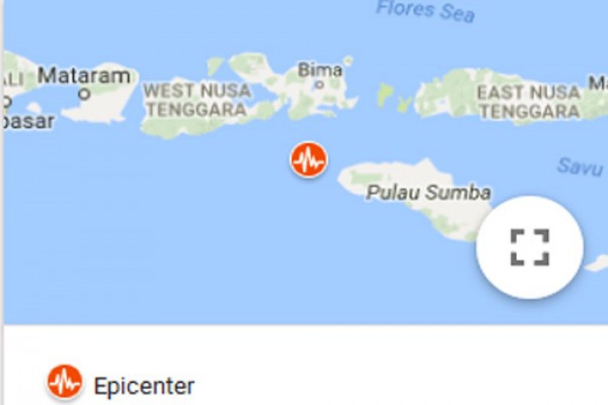
The epicenter of the earthquake was located at 9.19 degrees southern latitude and 118.61 degrees eastern longitude, or 79 km south of Bima District, West Nusa Tenggara Province, at a depth of 98 km.
The shakemap of BMKG showed that the earthquake could cause minor damage on a scale of intensity III SIG BMKG, or equivalent to V-VI MMI, in areas near the epicenter, such as the western and northern regions of Sumba and the southern area of Bima.
The earthquake was categorized as a medium-sized earthquake caused by subduction between the Indo-Australian plate and the Eurasian plate.
This plate subduction triggered a deformation in the Indo-Australian slab in the Beniof Zone at a depth of 98 km below the Lombok Basin.
Reporting by Desi Purnamawati
UU.a059/INE/o001
EDITED BY INE
(T.A059/B/KR-BSR/O001) 30-12-2016 11:47:12
Editor: Priyambodo RH
Copyright © ANTARA 2016
