Head of Volcanology and Geology Disaster Mitigation, Kasbani, revealed here on Saturday that the status of the volcano, having an altitude of 3,142 meters above sea level, remained on its highest alert level following comprehensive analysis through various parameters, such as its seismic activity, deformation, geochemical activity, and satellite imagery.
Mount Agung has experienced fluctuations in its seismic activity during its alert level IV status, with its highest frequency reaching 1,047 times, while on Friday, it only recorded 379 instances of seismic activity.
"Although the activity has declined, it (seismicity) remained high," Kasbani said.
However, the authority has shown greater concern following the decline in seismic activity of Mount Agung recalling that Mount Merapi in Central Java had erupted in 2006 after it had experienced a low seismic activity.
Likewise, Mount Sinabung in North Sumatra Province had erupted in 2013 after its status had been demoted to alert level III, Kasbani said.
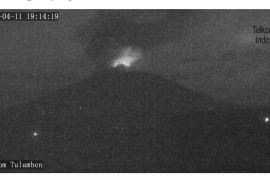
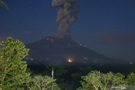
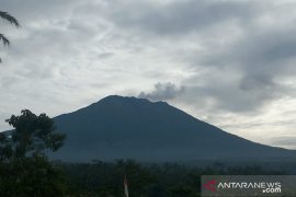
Meanwhile, visual observation has showed that there was a significant increase in visual activity on the volcanos surface.
The authority recorded that Mount Agung released a 100- to 500-meter-high tower of smoke comprising steam and gas from its peak.
Satellite imagery also showed the formation of new hot areas on the northeastern and central part of Agungs crater surface.
The hot areas have expanded significantly as shown by gas and steam blowing from fractures on its surface.
Moreover, satellite imagery showed water bursting out of the volcanos crater indicating a hydrologic disturbance inside the volcanos belly due to the movement of magma.
Kasbani also revealed that seismic data from nine observation stations around Mount Agung indicated that fluid networks had been formed below the volcano, while instrumental analysis showed deformation on the volcano indicating large magma pressure.
GPS measurements, or tiltmeter, also showed that Mount Agung experienced volcanic inflation at its peak as high as a six-centimeter increase during the September-October 2017 period.
However, no high levels of sulfur oxide gas were detected at 12 kilometers (km) and 3.5 km from the volcanos peak, Kasbani said.
Earlier, the status of Mount Agung was increased to its highest -- alert level IV, or Awas, -- on Sept 22 due to increasing volcanic activity.(*)
Editor: Heru Purwanto
Copyright © ANTARA 2017


