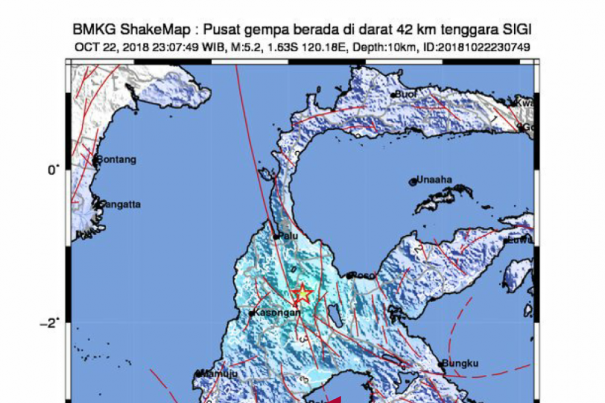
A 5.2-magnitude tremor hit Sigi District, Central Sulawesi Province, on Monday at 11:07 p.m. local time, while another quake measuring 4.7 on the Richter Scale jolted West Sumbawa, West Nusa Tenggara, on Tuesday at 2:39 a.m. Western Indonesian Standard Times (WIB), according to information from the Meteorology, Climatology and Geophysics Agency (BMKG), here, Tuesday.
The quake`s epicenter in Sigi was located at 1.63 degree southern latitude and 120.18 degree eastern longitude, some 42 km southeast of Sigi, and at a depth of 10 km.
Five minutes later, an aftershock jolted Sigi at a magnitude of 4.7.
On Sumbawa Island, West Nusa Tenggara, the quake`s epicenter was located at 9.32 degree southern latitude and 117.21 degree eastern longitude, some 75 km southeast of West Sumbawa, and at a depth of 55 km below sea level.
The tremor was felt at III MMI (modified mercalli intensity) by local inhabitants of West Sumbawa.
The earthquakes in Sigi and West Sumbawa did not have potential to trigger subsequent tsunami.
Meanwhile, at least four major earthquakes rocked West Nusa Tenggara (NTB) and Central Sulawesi during July-September.
Three powerful earthquakes rocked Lombok and Sumbawa Islands in NTB respectively on July 29, Aug 5, and Aug 9, 2018.
The death toll in Lombok Island reached 555. More than 1,300 people were injured, and nearly 353 thousand have been internally displaced.
In Central Sulawesi, a magnitude-7.4 earthquake and a subsequent tsunami struck the districts of Palu, Donggala, Sigi, and Parigi Moutong on September 28, 2018.
The Central Sulawesi earthquake and tsunami claimed 2,102 lives, injured 4,612, and rendered 680 others missing. A total of 68,451 homes were seriously damaged, and 78,994 people were displaced.
Reporting by Fardah Assegaf
Editing by Sri Haryati
Reporter: antara
Editor: Heru Purwanto
Copyright © ANTARA 2018
