The aftershock did not have potential to trigger a tsunami, according to the Meteorology, Climatology and Geophysics Agency (BMKG).
The quake's epicenter was located at the coordinates of 8.84 degree southern latitude and 112.41 degree eastern longitude, some 80 km southwest of Malang, and at a depth of 98 kilometers.
Malang and Blitar were hit by a 6.1-magnitude earthquake on Saturday (10/4) at 2 p.m. local time.
BMKG Head of Earthquake and Tsunami Mitigation Division Daryono said the earthquake had a broad spectrum of shocks that were felt by residents of surrounding districts up to Banjarnegara in Central Java and Bali.
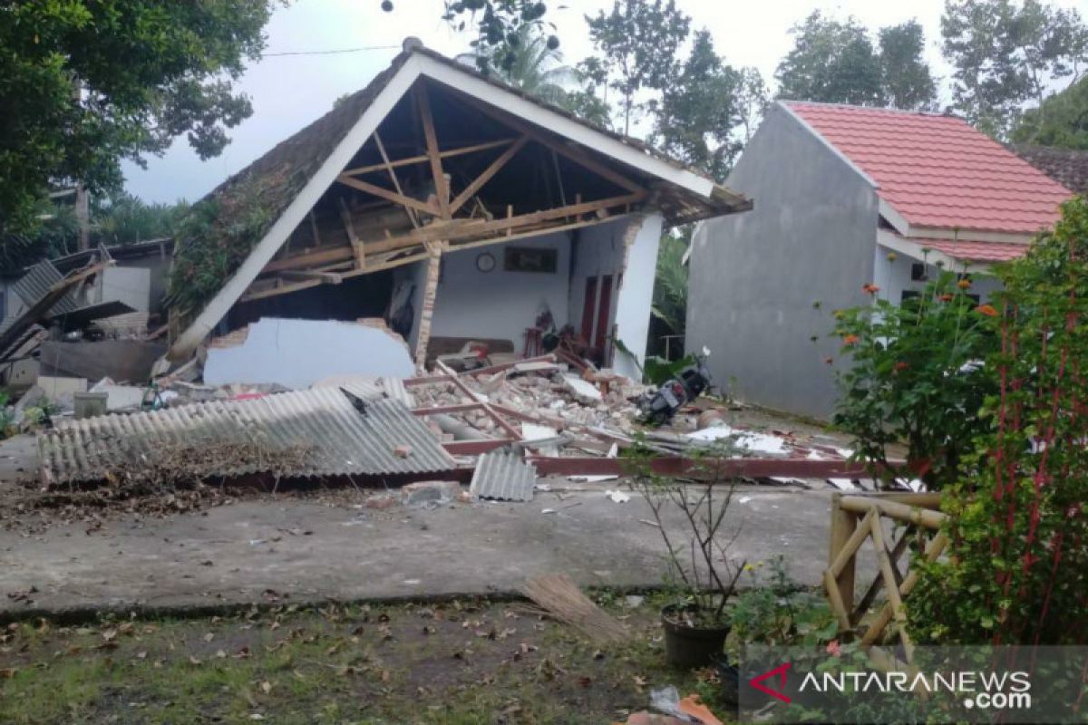
The earthquake caused damages to buildings in 16 districts and cities including Malang, Blitar, Lumajang, and Kediri in East Java.
Related news: BMKG warns of flash floods following Malang quake
Six people died and one person sustained serious injuries due to the earthquake, according to the National Disaster Mitigation Agency (BNPB) .
Three deaths were reported in Lumajang district, one in Malang district, and two between Lumajang and Malang, Head of the BNPB Center for Disaster Data, Information and Communication Raditya Jati said in a written statement released on Saturday.
According to the Lumajang District Disaster Mitigation Agency (BPBD), the quake forced residents of Kali village, Tempur Sari sub-district, Lumajang to flee their homes.
However, none of the residents in the districts of Malang, Blitar, Trenggalek, and Tulungagung had to take refuge elsewhere, he added.
He said several districts are still collecting data on the extent of the material damage caused by the quake.
Related news: Blitar: Several buildings damaged in 6.7-magnitude quake
Translator: Prisca Fardah
Editor: Rahmad Nasution
Copyright © ANTARA 2021


