The significance of research projects on earthquake potential in the island, located in the middle of Lake Toba, North Sumatra, is so obvious, according to UMI Rector Humuntal Rumapea, here, Saturday.
Rumapea made the statement following his discussion on earthquake issues in North Sumatra with Marzuki Sinambela, a research staff at the BMKG-Medan Office's Earthquake Regional Center.
He drew attention to the significance of bolstering public knowledge of earthquake, earthquake safety, and post-disaster challenges and opportunities in North Sumatra Province.
To this end, Rumapea has encouraged his university's scientists to team up with their counterparts from the BMKG to conduct joint research projects to gain greater clarity on earthquake-related issues in Samosir.
"We are encouraging our lecturers to seek research collaboration opportunities," he noted, adding that they could conduct research on earthquakes as well as hydrometeorological and geophysical hazards.
Meanwhile, Sinambela hinted that the agency will welcome any university offers for research collaboration.
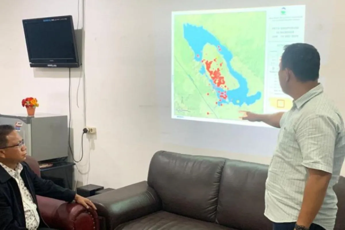
Sinambela also underscored the nature of the so-called "earthquake swarm" in Samosir Island.
He expounded that from the seismological perspective, seismic events in Samosir are "local" in nature that often occur within a relatively short period of time.
The BMKG recorded 253 earthquake events in Samosir during the period from January 24 to June 18, 2021, according to Sinambela.
Some 245 of the 253 earthquake events were categorized as earthquake swarm, while eight others were regarded as moderate earthquakes while their magnitudes varied from 0.9 to 5.2.
Due to a rising trend in natural hazards in North Sumatra, Sinambela deemed having sound knowledge of disasters as being crucial to serve BMKG's reliable information to related stakeholders.
Earthquakes regularly hit various parts of Indonesia since the country lies on the Circum-Pacific Belt, also called the Ring of Fire, where several tectonic plates meet and cause frequent volcanic and seismic activities.
Sumatra and various smaller islands off its coastal areas are prone to earthquakes.
Aceh Province, located at the northernmost tip of Sumatra Island, had also experienced the deadliest ever earthquake followed by a tsunami on December 26, 2004.
The catastrophe that also affected certain coastal areas in nations, including Thailand, Sri Lanka, and India, reportedly claimed some 230 thousand lives. Related news: 5.2-magnitude quake hits N Sumatra`s Samosir District
Related news: Within a week, 48 earthquakes hit North Sumatra, Aceh: BMKG
EDITED BY INE
Translator: Juraidi, Rahmad Nasution
Editor: Suharto
Copyright © ANTARA 2021


