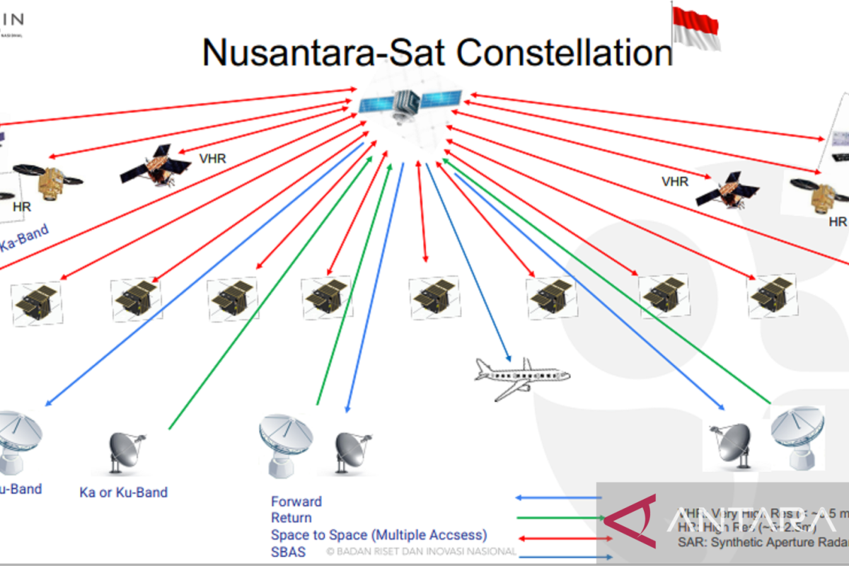
During the Indonesian Satellite Industry Ecosystem Bolstering Collaboration Webinar on Saturday, BRIN's Remote Sensing Research Center Acting Head Rahmat Arief noted that these satellites comprised four high-resolution satellites and two VHR satellites.
In addition, two Synthetic Aperture Radar (SAR) satellites, 10 constellation satellites for communication mission that utilize Low Earth Orbit (LEO), and one Geostationary Earth Orbit (GEO) satellite are in the process of development.
With the 10 constellation satellites, it is expected that communication connectivity in Indonesia can be ensured to proceed sustainably through continuous data delivery from each of these satellites.
These satellites will be launched gradually. In 2025, two VHR satellites are targeted to be launched, while in 2026, high-resolution satellites are targeted for launch.
These satellites will be beneficial, especially for acquisition or provision of Earth surface monitoring data for various purposes, such as agriculture, plantation, environment, fishery, and disaster.
Data from VHR satellites allows for a more detailed visualization of the Earth's surface, such as buildings, roads, or trees.
This will be highly beneficial, such as for urban mapping, land utilization, agriculture, and disaster management.
The opportunity to utilize radar satellite data or SAR in Indonesia is quite high due to the capability of SAR satellites to penetrate clouds.
Clouds often pose a problem for Earth surface monitoring that utilizes optic satellite data.
Radar satellites can also conduct surface monitoring without weather disturbances and can be utilized in the day and night.
Meanwhile, the Geostationary Earth Orbit satellite is a satellite orbiting at an altitude of 35,900 km above Earth. LEO satellite is a satellite orbiting at an altitude of 320-800 km.
Related news: Multifunctional satellites can enable fair Internet access: ministry
Related news: Ministry using satellite technology for fisheries surveillance
Translator: Martha H S, Fadhli Ruhman
Editor: Suharto
Copyright © ANTARA 2022


