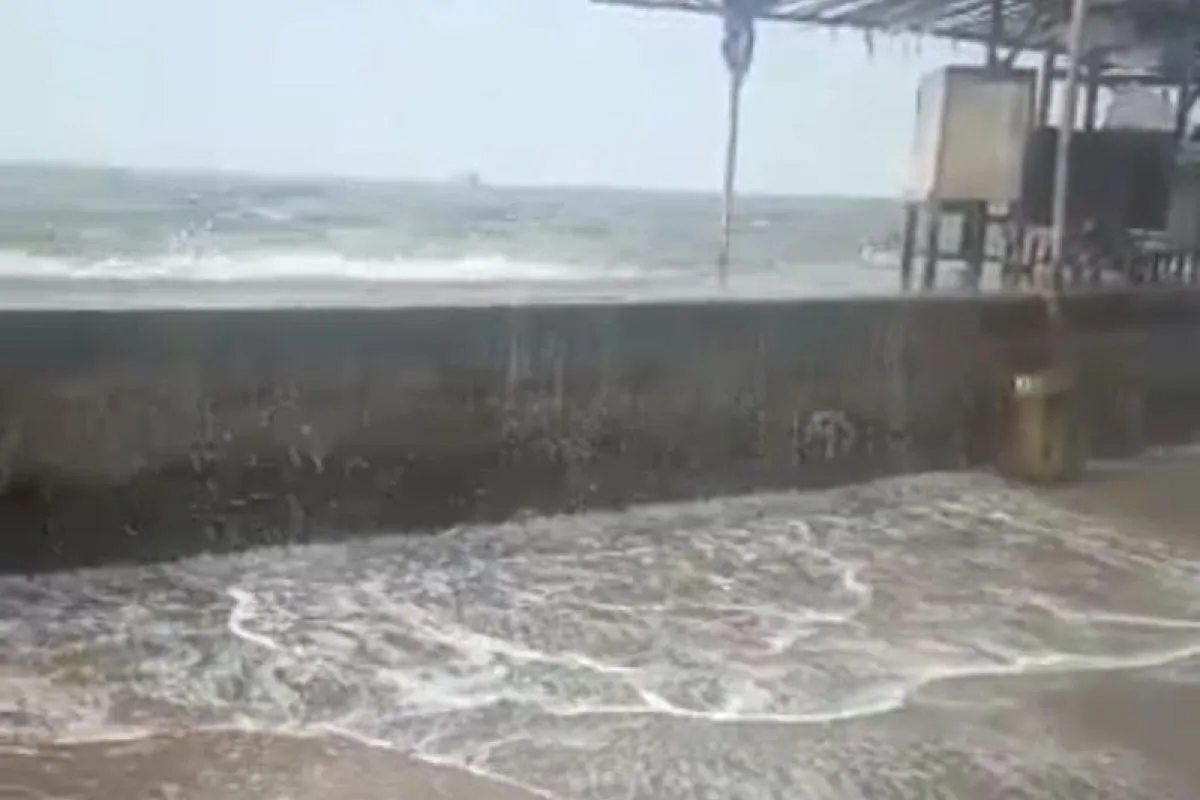
The high sea level, with the water height reaching +210 centimeters above sea level, triggered flooding in some coastal areas of northern Central Java, such as Semarang city, Pekalongan city/district, and Demak district, he added.
"The tide of +210 cm above sea level was extreme when compared to tidal records for the last 5 years (2017–2021), with the highest tide level at +180 cm above sea level," Atmawidjaja informed in a press statement issued on Tuesday.
Meanwhile, head of the Pemali Juana River Basin Center (BBWS), Muhammad Adek Rizaldi, said that the PUPR Ministry’s team has carried out emergency handling efforts in the regions, which included taking an inventory of damaged embankments and installing geo bags/jumbo bags to replace the embankments.
"We have also coordinated with the provincial government and city/district governments for emergency management plans as well as collecting data on affected areas, and also preparing flood control facilities such as water pumps and flood materials," Rizaldi informed.
The coastal flood that occurred, especially in Semarang city, was not caused by damaged embankments but rather due to high tides.
The Tanjung Emas Maritime Meteorological Station in Semarang, which recorded tidal hydrological data on the sea level, pegged the water height at +210 cm above sea level at 3 p.m. local time.
"Praise to God, since last night, the water level is at a level of +162 cm above sea level and has shown a downward trend," Rizaldi informed.
Based on temporary data from BBWS Pemali Juana, Directorate General of Water Resources of the PUPR Ministry, the coastal flood inundated Tanjung Emas Port, Semarang city, with the floodwater reaching a height of about 30–150 cm.
Meanwhile, the Meduri River, which passes through Pekalongan district/city, overflowed to inundate several residential areas and roads in Tegal Dowo village, Pasir Sari, Karang Jompo, Pacar, Samborejo, Meduri, Pulosari, and Mulyorejo.
The coastal flooding along the north coast of Java also affected parts of Demak district, including the Pantura-Demak Highway and residential areas in Pondok Raden Patah, with floodwaters reaching a height of up to 30–100 cm.
As part of efforts to tackle coastal flooding along the north coast of Java, the PUPR Ministry has integrated the construction of flood control infrastructure from upstream to downstream around Semarang city, including the establishment of Jatibarang Dam for upstream handling and flood canals, river normalization, installation of railway pumps, and building of retention ponds, including the Gerak Dam in West Flood Canal (KBB), for downstream handling.
To prevent tidal run-off, a tidal embankment stretching 2.17 kilometers from Sultan Agung Islamic University encircling the Terboyo industrial area to Sringin River has also been built. In addition, there are plans to integrate the under-construction 27-km Semarang-Demak Toll Road with the sea wall.
Related news: BMKG forecasts Java coastal flooding to last until May 25
Related news: C Java coastal flooding: Local govts asked to prepare emergency posts
Related news: Flooding forces 815 West Jakarta residents to leave home: BPBD
Translator: Aji Cakti, Resinta S
Editor: Sri Haryati
Copyright © ANTARA 2022


