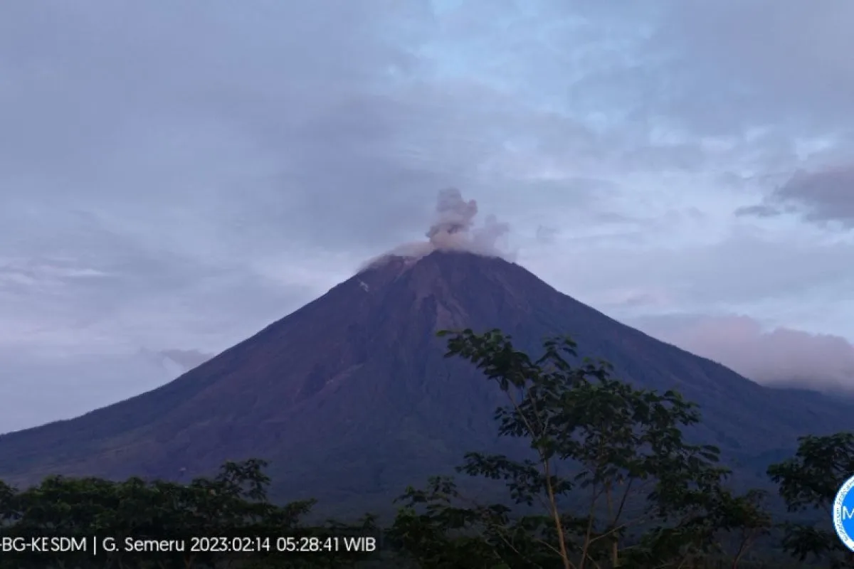
"The ash column was observed to be white to gray, with moderate to thick intensity towards the north. The eruption was recorded on a seismograph, with a maximum amplitude of 20 mm and a duration of 101 seconds," officer of the Semeru Volcano Observation Post on Mount Sawur, Ghufron Alwi, noted in a report received here, Tuesday.
Alwi explained that the activity of Mount Semeru, based on seismic observations on February 14, 2023, at 00:00-06:00 local time, showed 19 earthquakes, with an amplitude of 12-22 mm.
It was then followed by two earthquakes, with an amplitude of 4-5 mm; three earthquakes, with an amplitude of 4-9 mm; five earthquakes, with an amplitude of 2-5 mm; and one far tectonic earthquake, with an amplitude of 14 mm, Alwi stated.
Meanwhile, seismic observations at 06:00-12:00 local time recorded 20 eruption earthquakes, with an amplitude of 18-22 mm; three gust earthquakes, with an amplitude of 3-6 mm; and one harmonic tremor, with an amplitude of 18 mm, he noted.
Meanwhile, Mount Semeru is still placed on Alert status, or level III. People are urged to comply with several recommendations submitted by the Center for Volcanology and Geological Hazard Mitigation (PVMBG).
The community is prohibited from conducting any activities in the southeastern sector along Besuk Kobokan River as far as 13 kilometers from the peak, or the eruption center.
Beyond this distance, the community is also not allowed to conduct activities at a distance of 500 meters from the riverbank along Besuk Kobokan River since it can potentially be affected by the expansion of hot clouds and lava flows up to a distance of 17 kilometers from the summit.
"The community is also prohibited from carrying out activities within a radius of five kilometers from the crater of Mount Semeru, as it is prone to the danger of stones being spewed out of the crater," Alwi cautioned.
In addition, the public must be aware of the potential for hot cloud fall (APG), lava avalanches, and lava flows along rivers and valleys that start at the top of Mount Semeru.
"(This is) especially along Besuk Kobokan, Besuk Bang, Besuk Kembar, and Besuk Sat rivers as well as the potential for lava in small rivers that are tributaries of Besuk Kobokan," he said.
Related news: Subianto provides aid to people affected by Mount Semeru eruption
Related news: Zero fatalities from Mount Semeru eruption due to relocation: BNPB
Related news: Mount Semeru's status drops to standby level: Official
Translator: Zumrotun Solichah, Resinta S
Editor: Azis Kurmala
Copyright © ANTARA 2023


