"The distribution of landslides in Indonesia is 60, dominated by Java Island. Therefore, Java Island is indeed vulnerable," Head of the agency Sugeng Mujiyanto said at a press conference, which was followed from Jakarta on Friday.
He informed that in 2021, the number of ground motion incidents in Indonesia was recorded at 1,091 and they claimed 357 lives. In 2022, there were 1,085 landslides that killed 210 people.
Meanwhile, from January to March 24, 2023, there were 215 ground movement incidents that killed 84 people, he said.
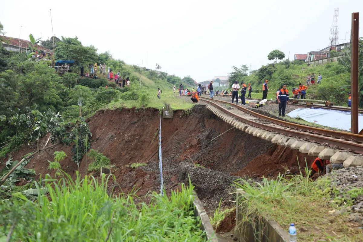
Meanwhile, Head of the Center for Volcanology and Geological Hazard Mitigation (PVMBG) Hendra Gunawan explained that the topology of Java Island is bumpy with a lot of steep inclines, especially in West Java province. Therefore, Java Island is vulnerable to ground movement.
In addition, the weathering of volcanic rocks is very common on Java Island. Volcanic rocks are quite volatile when interacting with high rainfall, Gunawan noted.
"If this interacts with slope conditions, rocks, and rainfall, it will trigger ground movement," he added.
Moreover, the dense population of Java Island also contributes to the number of ground movements, he said.
This is because the slopes that have the potential for ground movement have been utilized for residential purposes. In fact, the occurrence of ground movement has a lag of 10, 20, or even 30 years, Gunawan pointed out.
"People think if they live there, there will be no ground movement. However, in the next 10 to 30 years, it could happen," he disclosed.
He said that global warming could also worsen the occurrence of ground movements since extreme weather could increase the volume of rainfall.
Therefore, the Geological Agency is recording all ground movement events occurring in every region of Indonesia and carrying out approximate mapping on a more adequate scale, he said.
The estimated ground motion mapping is published every month, with information distributed to all district heads and also through the official website of the Geology Agency, Gunawan informed.
Related news: Lebak BPBD pegs losses due to natural disasters at US$516,000
Related news: Central Sulawesi's earthquake triggers mass movement to higher ground
Translator: Sugiharto Purnama, Resinta S
Editor: Rahmad Nasution
Copyright © ANTARA 2023


