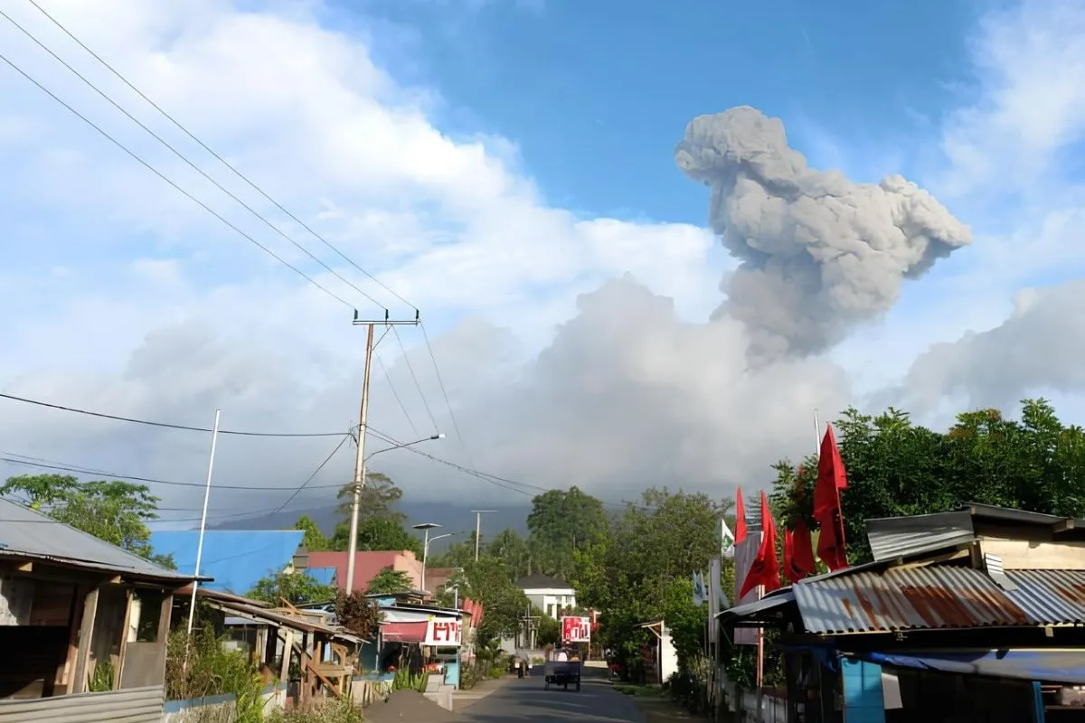
An officer from the Mount Ibu Monitoring Post, Axl Roeroe, stated that the eruption occurred at 11:29 a.m. Eastern Indonesian Time, with a maximum amplitude of 28 millimeters detected by the post's seismogram.
"The height of the ash columns appeared to reach 800 meters above the peak of the mountain," Roeroe stated in a report received in Jakarta.
The Volcanology and Geological Hazard Mitigation Center (PVMBG) has declared that Mount Ibu's volcanic status stands at Level II, advising people residing around the volcano against conducting outdoor activities within a radius of two kilometers from the eruption center.
The PVMBG also urged locals to beware of cold lava flows in the rivers connected to the peak of Mount Ibu and maintain coordination with the volcano monitoring post.
Related news: BPBD distributes masks to residents affected by Mount Ibu's eruption
On February 4 alone, Mount Ibu had triggered 19 eruption tremors, one avalanche tremor, 220 gust tremors, 250 shallow volcanic earthquakes, 14 deep volcanic earthquakes, two harmonic tremors, and seven distant tectonic earthquakes.
Moreover, in 2023, Mount Ibu was placed second among the most active erupting volcanoes recorded in Indonesia. Last year, the volcano experienced a total of 21,100 eruptions.
Mount Ibu constitutes a stratovolcano located along the northwest coast of Halmahera Island of North Maluku, with an altitude of 1,325 meters above sea level.
The peak of the mountain is a volcanic crater. The inner part of the crater spans one kilometer in width, with a depth of around 400 meters, while the outer crater is 1.2 kilometers wide.
Translator: Sugiharto P, Tegar Nurfitra
Editor: Yuni Arisandy Sinaga
Copyright © ANTARA 2024


