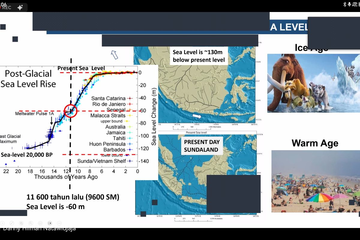
Sundaland is a term used by geologists and archaeologists to refer to the continental core of Southeast Asia, specifically the landmass that existed during the last ice age when sea levels were much lower.
"Sundaland is the only submerged landmass in the tropical region," he said during a scientific discovery workshop on the Sunda Shelf, which was followed from Jakarta on Monday.
According to Natawidjaja, Sundaland is tectonically unique because it is located at the junction of the Earth's plates, namely the Indo-Australian plate, the Australian plate, the Pacific plate, and the Eurasian plate.
The speed of the Indo-Australian plate's movement is around 70 millimeters per year, and that of the Pacific plate is 120 millimeters per year.
Related news: Geology Agency holds colloquium to deepen geological issues
During the last ice age, he said, the sea level was 130 meters lower than the mainland of Sundaland.
In 9,600 BC, the sea level was 60 meters lower than land. However, when the ice started to melt, it caused sea levels to rise and submerge Sundaland.
"Indonesia has around 127 active volcanoes. The famous mountains are Krakatau, Toba, and Tambora," Natawidjaja noted.
Indonesian areas within Sundaland are marked by epicenters of earthquakes. Some deadly sources are subduction zones and also other related phenomena that can trigger tsunamis.
However, when viewed from a geological perspective, Sundaland has a very long history with the subduction zone emerging at least 68 million years ago and becoming more active 45 million years ago, he informed.
"Sundaland is very unique because it is a long tectonic block," he added.
Related news: Spatial planning becomes crucial in disaster risk areas: Ministry
Translator: Sugiharto Purnama, Cindy Frishanti Octavia
Editor: Yuni Arisandy Sinaga
Copyright © ANTARA 2024
