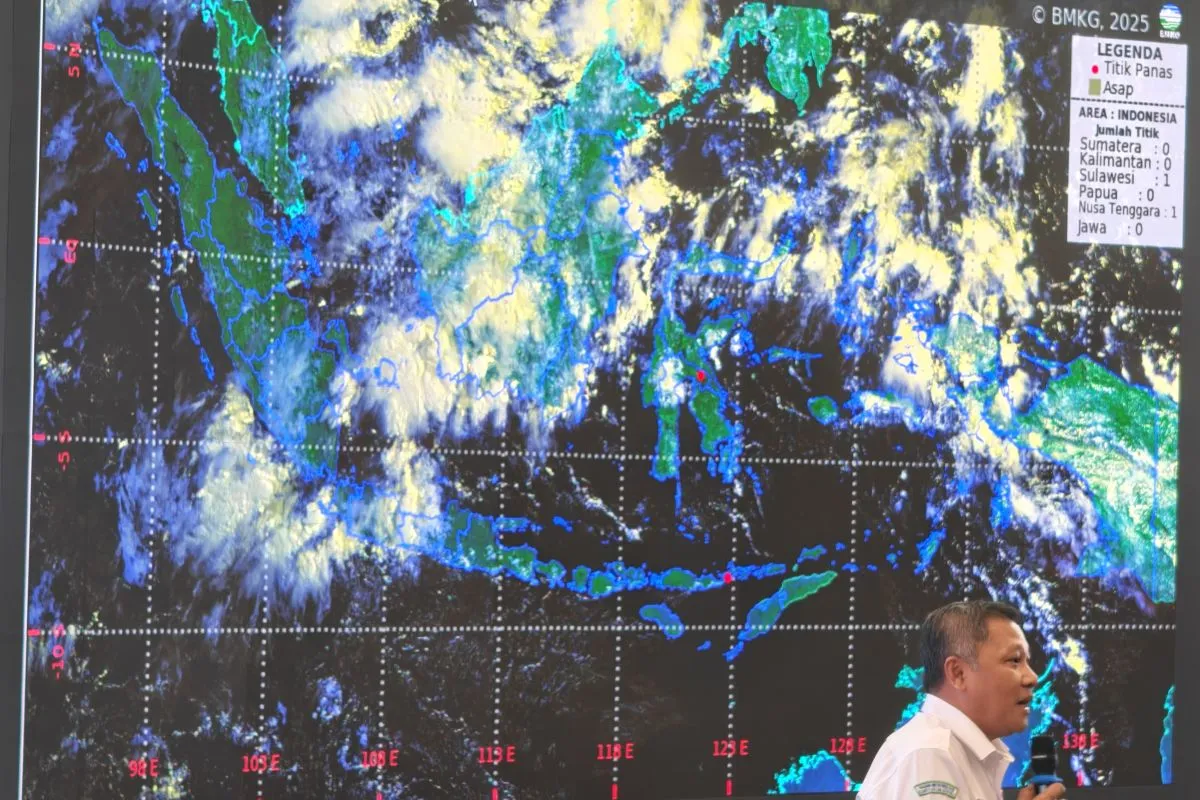
Deputy for meteorology at the BMKG, Guswanto, informed that the system utilizes data from several sources, including the National Oceanic and Atmospheric Administration (NOAA), to produce fire risk maps marked with green, orange, and red indicators.
“Red indicates active fires or firespots, orange shows high (fire) potential, and green means relatively safe. This data serves as a reference for weather modification operations and field patrols,” he said in Jakarta on Tuesday.
The BMKG meteorology team is using the FDRS, combined with satellite images, to monitor smoke distribution, wind direction, and potential cross-border haze.
Such information can enable the government to take preventive measures before fires spread, as seen in efforts to tackle forest and land fires in the six priority provinces of Riau, Jambi, South Sumatra, West Kalimantan, East Kalimantan, and South Kalimantan.
Guswanto informed that the BMKG routinely combines hotspot data with field monitoring by the Manggala Agni ground firefighting unit of the Ministry of Forestry and the aerial fleet of the National Disaster Management Agency (BNPB).
“This system has proven effective in determining daily priority areas for handling forest and land fires,” he said.
He stressed that prevention and early detection are far more effective than handling fires after they spread. With FDRS, the risks of environmental and health damage from forest and land fires can be reduced during the dry season, which is expected to end in September 2025.
Related news: Six priority provinces' fires are under control: BNPB
Related news: Ministry urges Banjarbaru govt to check forest fire spread
Related news: Government tackles 63 forest fires in East Kalimantan
Translator: Primayanti
Editor: Azis Kurmala
Copyright © ANTARA 2025


