The head of BNPB’s Disaster Data, Information, and Communication Center, Abdul Muhari, said that based on experience, evaluations, and scientific studies, large-scale floods have specific return periods after several years.
“In civil engineering, we know the term ‘flood return period.’ Some are 50 years, some 100 years. A major flood like the one in Bali is likely to occur again,” he said during a disaster briefing on Monday night (September 15).
His team is currently examining historical disaster data from past years to allow for accurate long-term mitigation strategies.
“The goal is to recover tourism in Bali, but we must not forget that disasters do not end with one incident. They will recur, especially if the triggering factors persist,” Muhari continued.
He reminded regional planners to consider environmental carrying capacity to avoid increasing disaster risks.
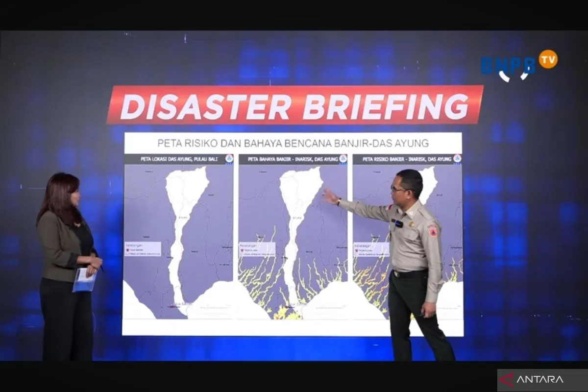
The agency reported that heavy rainfall caused rising water levels to the point where the Ayung River Basin (DAS) could not contain the floodwaters, inundating Badung, Jembrana, Buleleng, Karangasem, Gianyar, Bangli, and Denpasar—areas most affected by the flooding.
In his presentation, extreme rainfall data recorded on September 9–10 provide evidence that Bali is prone to hydrometeorological disasters. Almost all Meteorology, Climatology, and Geophysics Agency (BMKG) stations in southern Bali reported rainfall exceeding 200 millimeters per day.
Based on BNPB data, the disaster claimed the lives of 18 people, displaced 149 residents, and caused damage to homes and infrastructure.
Besides weather factors, Muhari noted that waste and land-use changes also exacerbated the flooding’s impact.
BNPB’s visual data showed many areas littered with trash, including along riverbanks and under river flows.
The agency also highlighted the shrinking of forests and agricultural land in Bali between 2012 and 2019, as land conversion to built-up areas further reduced water catchment areas.
Data show that forest loss reached 553 hectares and agricultural land nearly 650 hectares, significantly increasing the risk of flooding and other hydrometeorological disasters.
He added that existing spatial studies predict that by 2025 the built-up area in Denpasar could reach 35,000 hectares, a drastic increase compared with 2000.
“If buildings dominate areas with extreme rainfall, flooding will easily occur. We must return tourism to a balanced ecosystem,” he warned.
Related news: Bali to draft bylaw banning land conversion this year
Related news: Bali floods don't deter tourists, hotels still fully booked: Minister
Related news: Environment Ministry launches strategic assessment after Bali floods
Translator: M. Riezko Bima Elko Prasetyo, Resinta Sulistiyanda
Editor: M Razi Rahman
Copyright © ANTARA 2025


