BKKPN Kupang Coordinator for the Gili Trawangan, Meno, and Air marine area, Martanina, said the monitoring is part of the agency’s mandate to protect marine ecosystems within conservation areas.
“The last inspection was conducted some time ago, I can’t recall the exact month. At that time, we went down together with members of the House of Representatives. We will conduct another inspection,” Martanina said in a phone interview from Mataram on Monday.
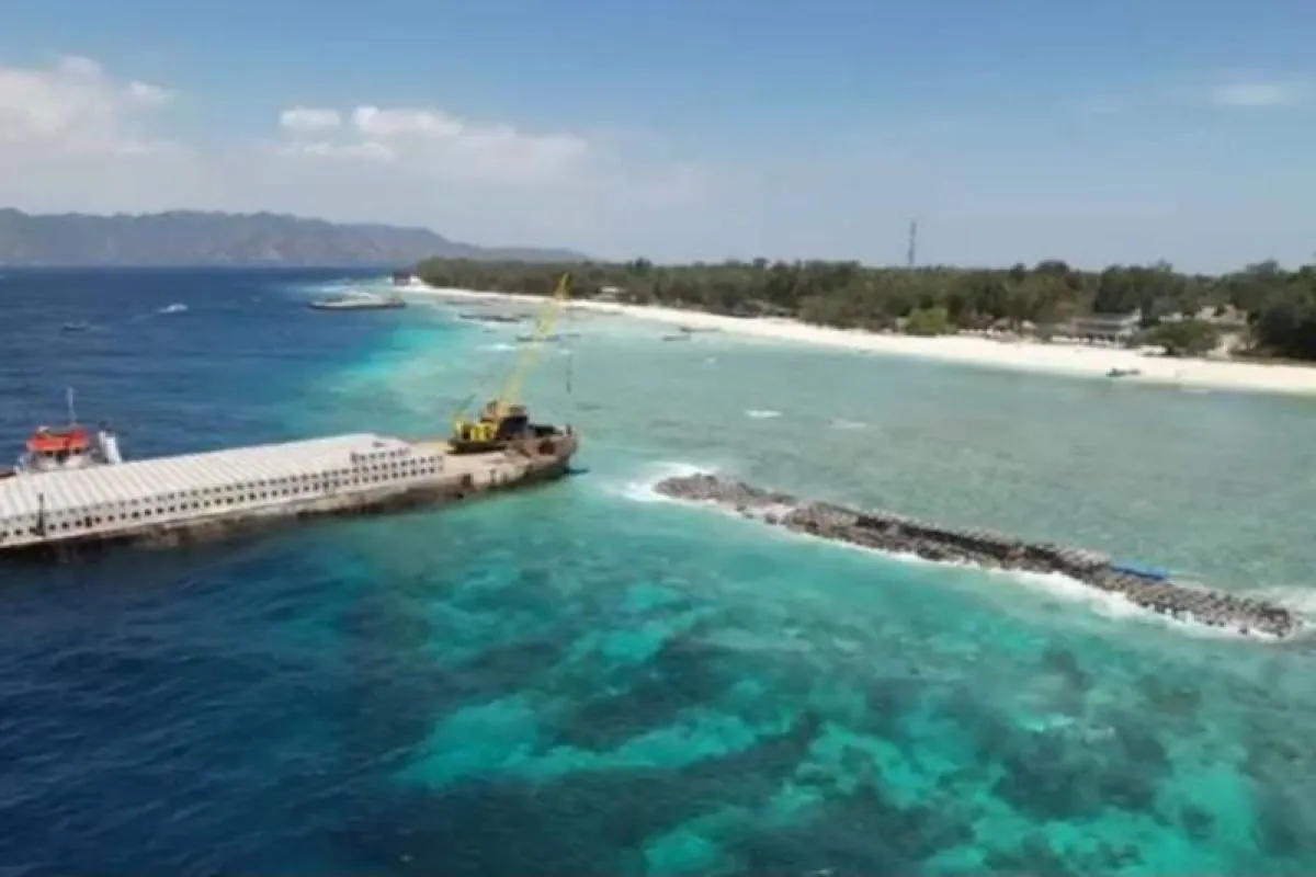
She explained that for the project, BKKPN has issued an approval for the suitability of marine spatial use for activities carried out in marine waters, namely the construction of breakwaters and groins.
“So, from the Ministry of Marine Affairs and Fisheries, only the marine spatial use approval was issued. Environmental impact assessments and other permits fall under the authority of the local government,” she said.
Meanwhile, permits for the construction of revetments along the coastal buffer zone of the Gili Meno tourism area are beyond BKKPN’s authority and have been handled by the River Basin Agency and the local government.
As part of the permitting process, the local government has expressed its commitment to carrying out marine ecosystem rehabilitation together with local communities.
To support the rehabilitation plan, BKKPN will also conduct field inspections to ensure post-project rehabilitation efforts are implemented properly and in line with established procedures.
“Yes, later they will carry out rehabilitation together with the Gili Meno community, and we will conduct inspections to ensure the rehabilitation follows existing standard operating procedures, including seed locations and other aspects,” she said.
Martanina said the abrasion prevention project, which is under the authority of the Ministry of Public Works and Public Housing, originated from concerns raised by communities in the Gili Trawangan, Meno, and Air tourism areas over the threat of coastal erosion.
“In 2019, there was indeed a request from communities on the three islands to prevent abrasion, because they considered it a serious threat,” she said.
The request was then forwarded by the local government to the central government and received a positive response from the National Development Planning Agency. The central government subsequently prepared a detailed engineering design in 2022.
“From the design, it was found that abrasion has been eroding the island by about 2.5 to 3 meters per year. Over the past 10 years, around 30 meters have been lost,” she said.
The mapping results were later discussed in a forum, leading to approval for the implementation of the abrasion prevention project from the coastal buffer zone to the surrounding waters of Gili Meno.
Martanina noted that not all proposed methods and locations were immediately accepted.
“At that time, several methods and locations were proposed, and we rejected some of them. If the location had good coral reefs and other sensitive ecosystems, we rejected it. We also rejected methods that could cause damage,” she said.
She expressed confidence that the project has gone through extensive studies and discussions before finally being implemented in 2025.
Previously, the project drew public attention and raised concerns among some foreign tourists about the potential damage to marine ecosystems.
These concerns stemmed from the use of heavy equipment to move construction materials, including piles of rocks along the coastal buffer zone and into marine waters.
Related news: West Aceh plants thousand trees to combat coastal erosion
Related news: BNPB installing eco-friendly gabions against abrasion in Central Java
Related news: Balancing biodiversity and disaster mitigation efforts with mangroves
Translator: Dhimas Budi Pratama, Primayanti
Editor: Azis Kurmala
Copyright © ANTARA 2025


