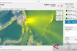
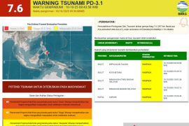
According to the Meteorology, Climatology and Geophysics Agency (BMKG) official website, the epicenter of the earthquake was located at 0.61 degrees southern latitude and 133.55 degrees eastern longitude at a depth of 10 km under the sea level.
It said that earlier, at 11.39 pm on Friday, another earthquake measuring 5.6 on the Richter scale also happened some 240 kilometers northwest of Saumlaki in West Southeast Maluku district.
Earlier on Friday morning two consecutive earthquakes jolted Southeast Maluku district city of Tual, and Gorontalo in Sulawesi.
At 2 am East Indonesia Standard Time (WIT), an earthquake measuring 5.1 on the
Richter scale jolted Tual but it did not have a potential to trigger a tsunami.
The Meteorology, Climatology and Geophysics Agency (BMKG) said the epicenter of the temblor was located 5.23 degrees southern latitude and 130.25 degrees eastern longitude at a depth of 30 kilometers in the sea, some 280 kilometers northwest of Tual.
Then at 7.04 am Central Indonesia Standard Time another earthquake measuring 5.3 on the Richter scale rocked Gorontalo in Sulawesi.
Its epicenter was located 0.94 degrees southern latitude and 124.19 degrees eastern longitude at a depth of 10 kilometers in the sea, 206 kilometers southeast of Gorontalo.
But there was no immediate report of tsunami, casualties or material damage caused by the earthquake, BMKG spokesman Hassan said in Gorontalo on Friday morning.
He said the earthquake was felt by a number of people in the city of Gorontalo but did not last long.
Gorontalo was jolted by a powerful earthquake measuring 7.7 on the Richter scale in November 2008, destroying thousands of houses and leaving one people killed. (*)
Editor: Jafar M Sidik
Copyright © ANTARA 2011

