The quake`s epicenter located 7.38 degrees southern latitude and 105.97 degrees eastern longitude, at a depth of 23 km, around 83 km southeast of Ujungkulon, according to information from the National Meteorological, Climatology and Geophysics Agency (BMKG).
"The earthquake did not have potential to trigger a tsunami," BMKG said on its official website.
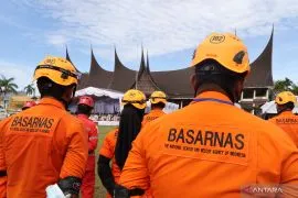
Reports on possible damages and casualties were not immediately available.
Jakarta`s residents, including journalists who were covering the activities of Vice President Boediono at the vice presidential palace on Jalan Medan Merdeka Selatan, felt the temblor.
ANTARA`s editors working on the 20th floor of WISMA ANTARA also experienced the tremor quite strongly.
The Sukabumi inhabitants felt the earthquake but they stayed calm, according to Perry A Furqon, head of the Sukabumi disaster mitigation office.
On Monday (April 4), a magnitude-7.1 earthquake rocked Central Java`s Cilacap district at 3.06 am and caused massive panic to the local residents.
A number of them ran to nearby hills in Ayah sub-district, Kebumen district, to avoid a possible tsunami, which did not occur, Head of Ayah subdistrict, Ahmad Bahrun, said.
hmad Bahrun said many of the residents were also shocked by the strong earthquake.
They rushed out their homes to go to higher ground but later returned to their villages shortly after they stopping receiving tsunami warning, he said.
Ayah sub-district is located near the sea and therefore prone to a tsunami, he said adding that he had yet to know the material loss and damage caused by the earthquake, he said.
Ahmad Lani of the Meteorology, Climatology and Geophysics Agency (BMKG) said earlier that the strong earthquake`s epicenter was located 10.01 degrees southern latitude, 107.86 degrees eastern longitude, at a depth of 10 km some 293 km southwest of Cilacap.
Various parts of Indonesia are naturally vulnerable to earthquakes because this archipelago is located on what it is called the "ring of fire".(*)
F001/HAJM
Editor: Jafar M Sidik
Copyright © ANTARA 2011