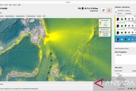
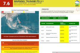
Karangkates Meteorology, Climatology and Geophysics Agency (BMKG) spokesman Adi Supriyanto said the epicenter of the earthquake was located 9.55 southern latitude and 112.55 eastern longitude at a depth of 25 kilometers under the sea level, about 170 kilometers southeast of Blitar.
"But it has no potential to trigger a tsunami, and so far there was no report of casualties or material damage in Blitar and Malang," Adi Supriyanto said.
He said the earthquake was strongly felt by the people in Malang and Blitar who scrambled out of their houses for fear of an aftershock.
Lying in an area of intense seismic activity where several tectonic plates collide, the Indonesian archipelago had frequent earthquakes.
Last Thursday afternoon on May 12, an earthquake measuring 5.7 on the Richter scale shook Banda Aceh and environs, causing panic among people in high rise buildings.
The epicenter of the quake which struck at 02.41 p.m. was in the sea 71 km southwest of the Aceh provincial capital at a depth of 33 km, spokesperson of the local meteorology, climatology and geophysics office, Vina said.
But the quake was not strong enough to trigger a tsunami, casualties or material damage.
Aceh province was last hit by a strong quake measuring 6.0 on the Richter scale on April 28, with its epicenter 63 kilometers northwest of Meulaboh, West Aceh district, at a depth of 20 km.
Many people panicked and rushed out of their houses or office buildings as they felt the strong tremors.
Aceh bore the brunt of a 8.9-magnitude undersea earthquake that unleashed a devastating tsunami on December 26, 2004, killing more than 200,000 people
(*). 2
Editor: Bambang
Copyright © ANTARA 2011

