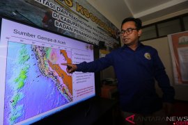
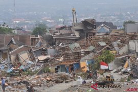
Local Meteorology, Climatology and Geophysics Agency (BMKG) in its official website said the first temblor measuring 5.7 on the Richter scale rocked Poso district at 6.53 Central Indonesia Standard Time (WITA) on Friday morning with the epicenter located at 0.71 degrees southern latitude and 121.89 degrees eastern longitude at a depth of 10 km.
The first earthquake with no potential of creating tsunami was located some 147 km northeast of Poso district.
Later at 1.39 on Friday afternoon the second earthquake with the epicenter at 0.14 degrees northern latitude and 120.30 degrees eastern longitude at a depth of 41 km occurred in Tolitoli district.
People in Palu city, about 200 km away from Poso and Tolitoli, also felt the magnitude of the two earthquakes for about 6 seconds.
Indonesia`s 17,000 islands are scattered along a belt of volcanic and seismic activity known as the Pacific "Ring of Fire", and that the area is one of the most quake-prone places on earth.
Early Wednesday morning, Nov 30, 2011, an earthquake measuring 5.4 on the Richter scale jolted Bengkulu, awakening the local people who were sleeping soundly to scramble out of their houses in panic.
BMKG said the epicenter of the temblor which was located at 4,44 degrees southern latitude and 102.09 degrees eastern longitude at a depth of 23 km, or about 74 km southwest of Bengkulu, did not have the potential to trigger a tsunami.
In 2007, Bengkulu was jolted by a magnitude-7.9 earthquake that destroyed many buildings and killed tens of people.
(Uu.O001/HAJM)
Editor: Priyambodo RH
Copyright © ANTARA 2011
