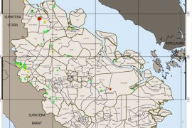
"The 140 hotspots were detected by the Modis satellite, with Terra and Aqua sensors owned by NASA, on Monday (Sept 12)," BNPB spokesman Sutopo Purwo Nugroho said here Tuesday.
Most of the fires were from slash-and-burn activities to clear land for farming and plantation in the Sekadau, Ketapang, Landak and Sanggau districts.
The Himawari satellite on Tuesday afternoon also detected smoke or haze in the districts of Ketapang and Sekadau in West Kalimantan Province and in the Katingan District in Central Kalimantan Province.
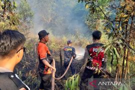
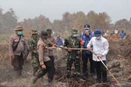
A joint team of forest fire task force comprising personnel from the military, police, local BNPB offices, local authorities and volunteers, have been working to put out the fires.
The BNPB has deployed two water bombing helicopters, Bolco and Bell 214, as well as one Indonesian Air Forces Casa aircraft, to help create artificial rains.
Efforts to extinguish wildfires have been intensified following the forest fire emergency status declared in 10 districts in West Kalimantan.
Some 3,500 personnel have been deployed for the effort.
The 10 districts are Kubu Raya, Mempawah, Landak, Bengkayang, Sanggau, Sekadau, Sintang, Melawi, Kapuas Hulu and North Kayong.
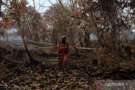
A total of 600.6 hectares of forest and land areas have been gutted by fires in West Kalimantan.
Of the total areas, 509 hectares are land belonging to local farmers, 1.6 hectares are plantation area, and 90 hectares conservation area.
Lack of water and slash-and-burn methods are among problems hampering efforts to put out and prevent wildfires.
In the meantime, the Terra and Aqua satellites of NASA detected 37 hotspots in five provinces across Sumatra Island on Sunday.
The number of hotspots increased significantly from only three on Saturday, Slamet Riyadi, spokesman of the Pakanbaru meteorology station, said.
Of the 37 hotspots, 25 were found in Bangka Belitung, six in South Sumatra, three in Lampung, two in Bengkulu, and one in Riau.(*)
Editor: Heru Purwanto
Copyright © ANTARA 2016

