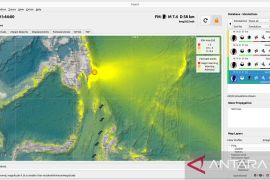
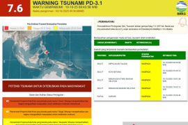
The epicenter of the earthquake was recorded at the 2.26 degrees Southern Latitude and 133.86 degrees Eastern Longitude at a depth of 10 kilometers, and some 70 kilometers southeast of Bintuni Bay district.
But so far there is no official report from local authorities about fatality and material damage from the earthquake.
Indonesias more than 17 thousand islands are scattered along a belt of volcanic and seismic activity known as the Pacific "Ring of Fire", and that, the area is one of the most quake-prone places on earth.
Earlier on Sunday, two moderate earthquakes measuring 4.8 and 3.9 on the Richter scale respectively jolted Wakatobi District in Southeast Sulawesi Province and West Sumba District in East Nusa Tenggara Province.
In Wakatobi, the tremor occurred at 2:15 a.m. local time and its epicenter was located at 5.91 degrees southern latitude and 123.97 degrees eastern longitude, and at a depth of 44 km, Rosa Amelia, head of the Kendari geophysics office, said in Kendari, Sunday.
Its intensity was at III-IV MMI (Modified Mercalli Intensity) and was felt by many local inhabitants.
"The earthquake did not have potential to trigger a tsunami," she said.
In West Sumba, the tremor happened at 5:26 a.m. local time, and its epicenter was located at 9.49 degrees southern latitude, 114.45 degrees eastern longitude, and at a depth of 77 km, Sumawan, an officer of the Kupang geophysics office, said in Kupang, Sunday.(*)
Editor: Heru Purwanto
Copyright © ANTARA 2016

