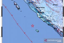
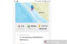
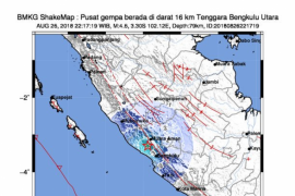
According to the Meteorology, Climatology, and Geophysics Agency, the epicenter of the earthquake that hit Bengkulu at 10.58 pm local time was located around 55 kilometers away from southwest of the city at a depth of 59 km.
The agency did not issue a tsunami warning.
Due to the fact that Indonesia lies on the Circum-Pacific Belt, which is also known as the Ring of Fire, it has become this nation`s destiny if many tectonic plates meet and cause frequent volcanic and seismic activities.
Over the past four months, a string of earthquakes has continuously been shaking different parts of Indonesia, and no one in the country exactly knows when these natural disasters stop threatening the archipelago.
In August and September, a series of deadly earthquakes hit the Indonesian island of Lombok in West Nusa Tenggara Province as well as the city of Palu and districts of Donggala and Sigi in Central Sulawesi Province, living several thousands of people dead.
According to the National Disaster Mitigation Agency (BNPB), the disaster is expected to have made the Central Sulawesi Province suffer material losses of at least Rp10 trillion.
The central government, as revealed by Vice President Jusuf Kalla, has set a targeted time of finishing the rehabilitation and recovery endeavors within two years.
On October 11, 2018, a 6.3-magnitude earthquake also rocked the East Java and Bali regions.
It did not merely cause three people to get killed and several houses in East Java to get damaged, but its tremors could also be felt by many of those staying in the resort island of Bali for attending the IMF-World Bank meetings.
Reporting by Benardy Ferdiansyah
Editing by Rahmad Nasution
Reporter: antara
Editor: Heru Purwanto
Copyright © ANTARA 2018


