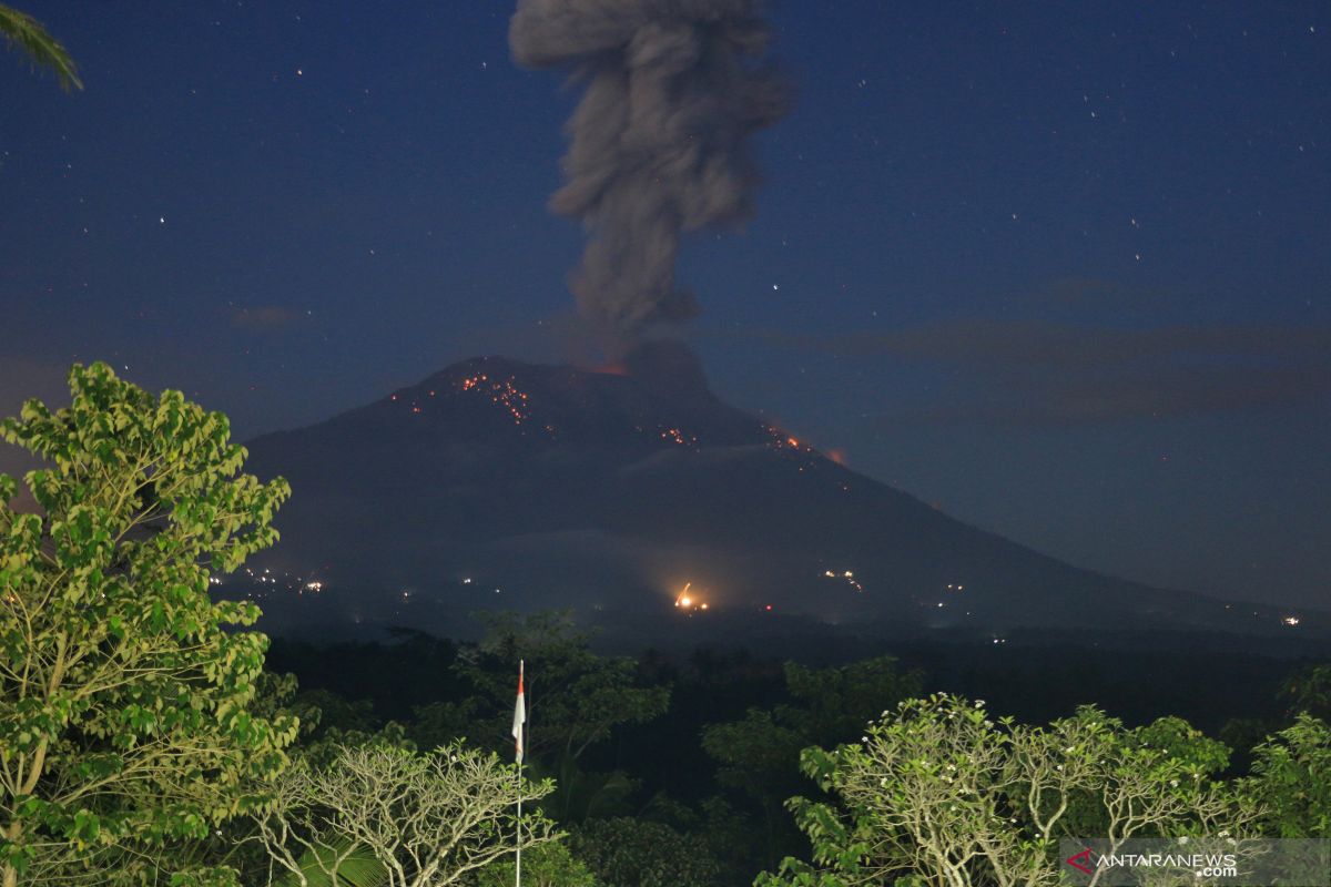
"People who live and move around the rivers whose upstreams are in Mount Agung are aware of the potential secondary threat of rain lava flows," said the warning posted on the official PVMBG website on Monday.
The volcano with Level III (standby) activity levels has erupted since November 21, 2017 and on May 12, 2019 experienced a single eruption earthquake, five gusts of earthquake, two distant tectonic earthquakes, according to PVMBG.
Meanwhile, the Mount Agung Monitor Post officer reported the presence of incandescent material as far as approximately 3,000 meters to the west and northwest.
"Last night I heard a thud and a loud noise from here. Residents had rushed out of their houses. But they remained calm," said Dewa Ngakan Klaci, a resident of Nongan Village, Karangasem, adding that residents living around are used to hearing the boom from Mount Agung.
On Monday, the seismograph recorded a single earthquake of gusts and one long tectonic earthquake
Translator: Bambang Purwanto
Editor: Fardah Assegaf
Copyright © ANTARA 2019


