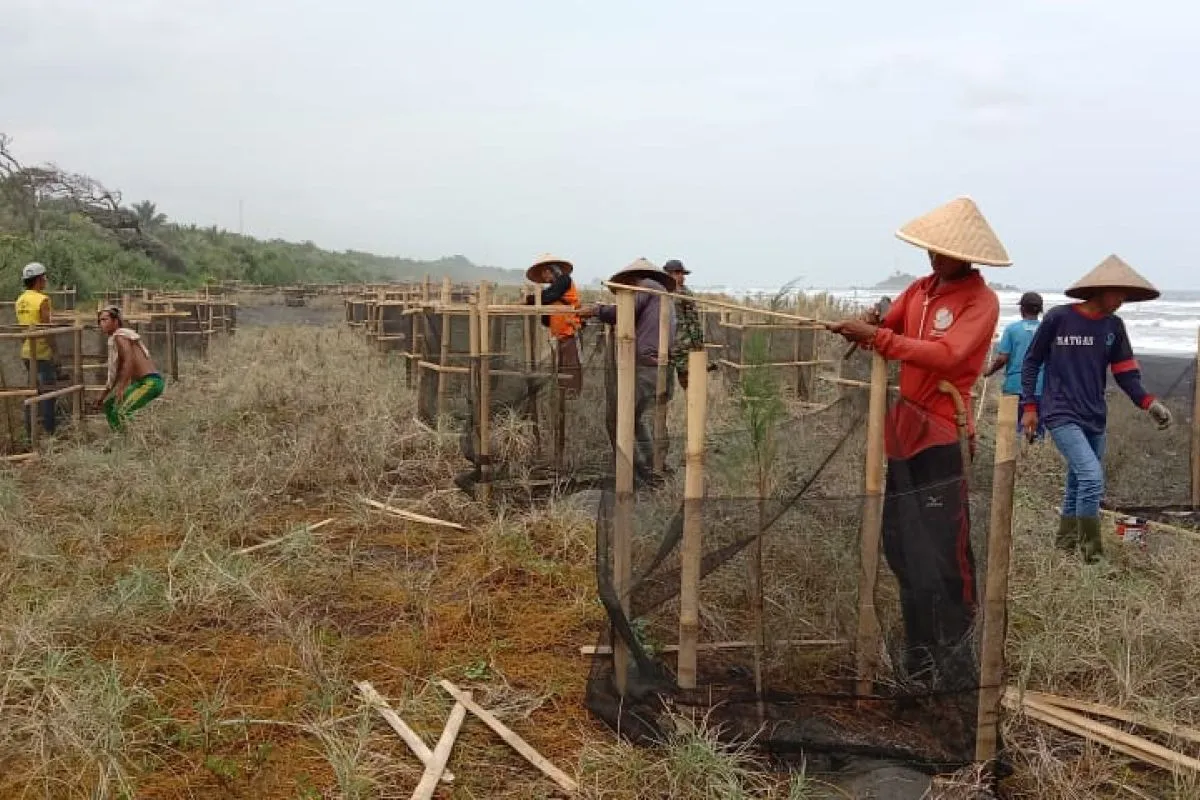
The configuration of coastal vegetation, with a certain density, will form a green belt that proffers several benefits for the environment and society.Jakarta (ANTARA) - The Ministry of Marine Affairs and Fisheries conducted coastal vegetation planting with 6,300 seedlings at five locations in South Pesisir District, West Sumatra, to boost the resilience of coastal areas against tsunami disasters.
Acting Director General of Marine Space Management at the ministry Suharyanto noted in a press release received here, Wednesday, that parts of Indonesia's coast were prone to tsunami disasters.
Suharyanto noted that the west coast of Sumatra, southern Java, southern Nusa Tenggara, Maluku Islands, some parts of Sulawesi Island, and also Papua where beaches are dominated by sand with gigantic sea waves were susceptible to tsunamis.
Hence, Suharyanto remarked that non-mangrove vegetation, such as sea fir, coconut, and ketapang (Terminalia catappa), were deemed more suitable for planting purposes.
Related news: Riau Islands: BRGM aims to restore 4,617 ha of mangroves
"The problem of disasters afflicting coastal areas must elicit the government's attention, so that the disaster risk can be suppressed, especially for residents living in coastal areas. Hence, the marine ministry is conducting coastal vegetation planting in South Pesisir District," he explained.
He further expounded that the configuration of coastal vegetation, with a certain density, will form a green belt that proffers several benefits for the environment and society.
He highlighted that the green belt offered tangible advantages, both environmentally and economically. For tsunami-prone areas, the perks will increase if the belt is designed for tsunami disaster mitigation.
Related news: Marine Ministry to get additional budget for mangrove rehabilitation
The twin earthquakes in the west coast of Sumatra were generated from the Mentawai Megathrust, Mentawai Fault System (MFS), and Sumatra Fault System, or more popularly known as the Great Sumatran Fault, he pointed out.
This active fault has caused several tsunamis such in 2009 on the coast of Padang City and in 2010 on Mentawai Island.
Director of Coastal And Small Islands Utilization Muhammad Yusuf drew attention to five locations of non-mangrove coastal vegetation in South Pesisir S District spread in Nagari Sago Salido Sub-district, Muara Anakan Village, Sungai Tawa Village, Nagari Nyiur Melambai Sub-district, and Nagari Muara Kandis Punggasan Sub-district.
"Taking into account the fact that sandy shores constitute the local substrates, the type of vegetation planted is sea fir. Sea fir also dominates the target planting area," he noted.
Related news: Jakarta Govt, JXB hold virtual event to engage healthcare workers
Related news: Wisma Atlit still offering treatment to 1,678 COVID-19 patients
Translator: M Razi, Kenzu T
Editor: Fardah Assegaf
Copyright © ANTARA 2021


