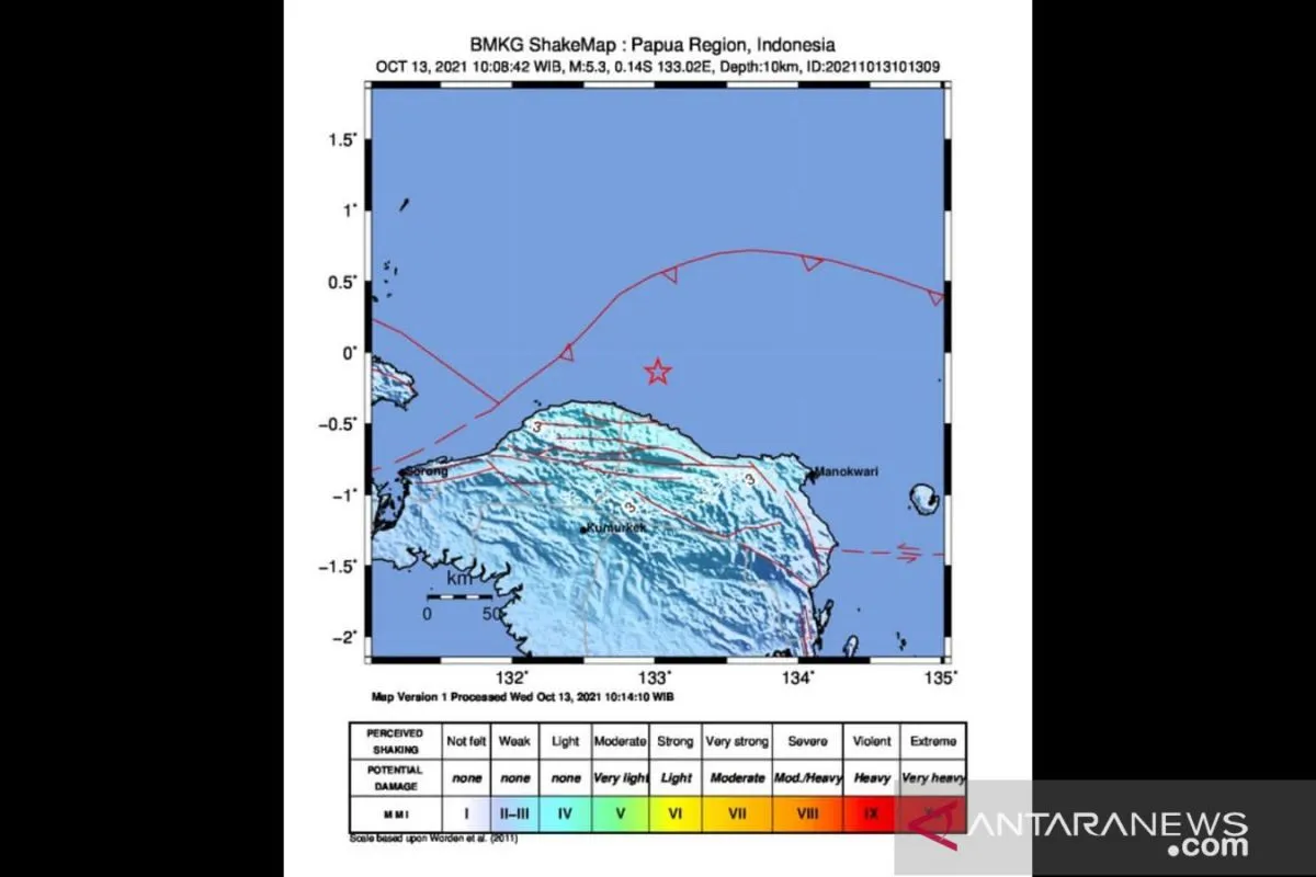
The earthquake that struck at 10:08 a.m. Western Indonesia Standard Time (WIB) was located at the coordinates of 0.14 degrees south latitude and 133.02 degrees east longitude.
The epicenter of the quake was located at around 99 kilometers away from Tambrauw District at a depth of 10 kilometers, according to Jakarta-based Meteorology, Climatology, and Geophysics Agency (BMKG).
Related news: Magnitude-4.3 earthquake hits Papua's Jayapura District
Earthquakes regularly strike various parts of Indonesia since the country lies on the Circum-Pacific Belt, also known as the Ring of Fire, where several tectonic plates meet and cause frequent volcanic and seismic activities.
Akin to several other provinces in the archipelago, Papua and West Papua are also prone to earthquakes.
Strong earthquakes have repeatedly jolted certain parts of Indonesia's western half of the island of New Guinea over the past decade.
On January 13, 2021, a 5.7-magnitude earthquake jolted southeast of Waropen District in Papua, though it did not have the potential to generate a tsunami.
On January 18, 2020, a 6.0-magnitude tectonic earthquake rattled the districts of Jayapura and Sarmi in this eastern Indonesian province.
One of the deadliest earthquakes to have hit Papua was in Serui of Yapen Island and other coastal areas in which several local residents lost their lives and numerous houses were damaged.
Related news: No Indonesian casualties in Australia's earthquake: official
According to the BMKG-Sorong office, some 1,040 earthquakes jolted various parts of West Papua in 2020, with 27 quakes striking the province in the month of September alone.
The average magnitudes of the earthquakes that rattled West Papua in September 2020 were recorded at three and four.
Sorong District is vulnerable to earthquakes, as it lies on the Circum-Pacific Belt, also known as the Ring of Fire.
Its vulnerability is also a result of the "Sorong fault" that runs through the fault zone in Sulawesi Island, which triggered the Palu and Majene earthquakes.
Sorong District has repeatedly been rocked by strong earthquakes over the past decades. In 2009, a 7.9-magnitude earthquake jolted Manokwari District and triggered a tsunami in Ransiki Town.
On September 26, 2015, a 6.0-magnitude earthquake jolted Sorong District's Tanjung Kasuari.
Related news: Indonesia, Serbia to mutually recognize vaccine certificates
Related news: PON seen boosting Papua economy by 1.5 percent: official
Translator: Devi NSR, Rahmad Nasution
Editor: Fardah Assegaf
Copyright © ANTARA 2021


