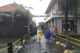
Currently, the cyclonic seed 90S in the South Indian Ocean in West Java can likely cause heavy rain that is sometimes accompanied by lightning and strong windsCilacap (ANTARA) - The Meteorology, Climatology, and Geophysics Agency (BMKG) reminded residents of the southern part of Central Java and central mountains in Central Java to remain vigilant to likely extreme weather in the next three days.
"Currently, the cyclonic seed 90S in the South Indian Ocean in West Java can likely cause heavy rain that is sometimes accompanied by lightning and strong winds," Head of the BMKG Technician Group, Teguh Wardoyo, noted on Monday.
The potential for extreme weather is also influenced by cyclonic circulation in the western waters of Aceh, Anambas waters, and the North Natuna Sea, he added.
In addition, wind convergence occurred in the West Indian Ocean of Bengkulu, Lampung waters, Java Sea, Sumba southern waters, southern Indian Ocean East Nusa Tenggara, North Natuna Sea, Central Kalimantan waters, Tanimbar waters, Sarmi waters, Aru Sea, and Agats waters.
Related news: BMKG to prepare national action plan for climate change adaptation
Wind deflection or shear also occurred in the Aceh waters, Malacca Strait, southern Sunda Strait, southern Indian Ocean of West Java, Flores Sea, Banggai Bay, Tomini Bay, Gorontalo waters, Sulawesi Sea, Sangihe/Talaud waters, and northern Morotai waters.
"We remind people in the southern and mountainous regions of Central Java to be aware of the potential extreme weather," Wardoyo emphasized.
Related news: Amin asks regions to prepare disaster mitigation measures
Responding to a query on the impact of cyclonic 90S on the increase in wave height in the southern seas of West Java to Yogyakarta, he noted that no early warning of high waves had been received.
However, the BMKG did not rule out the possibility of issuing an early warning for high waves in the southern waters of West Java-Yogyakarta and the southern Indian Ocean of West Java-Yogyakarta in line with the development of the cyclonic 90S, he remarked.
"What is clear is that due to the presence of these cyclone seeds, the wind speed will increase. It is possible that the wave height will increase. We will continue to monitor the development of the cyclone seeds. If there are further developments, we will immediately inform the public," he added.
Related news: Finance Ministry optimistic of 95% PEN stimulus absorption by year-end
Related news: Flood swamps 422 homes in Banten's Lebak Districk
Translator: Sumarwoto,Resinta S
Editor: Fardah Assegaf
Copyright © ANTARA 2021


