The agency's Earthquake and Tsunami Mitigation Coordinator, Daryono, disclosed the information on being contacted from here on Tuesday.
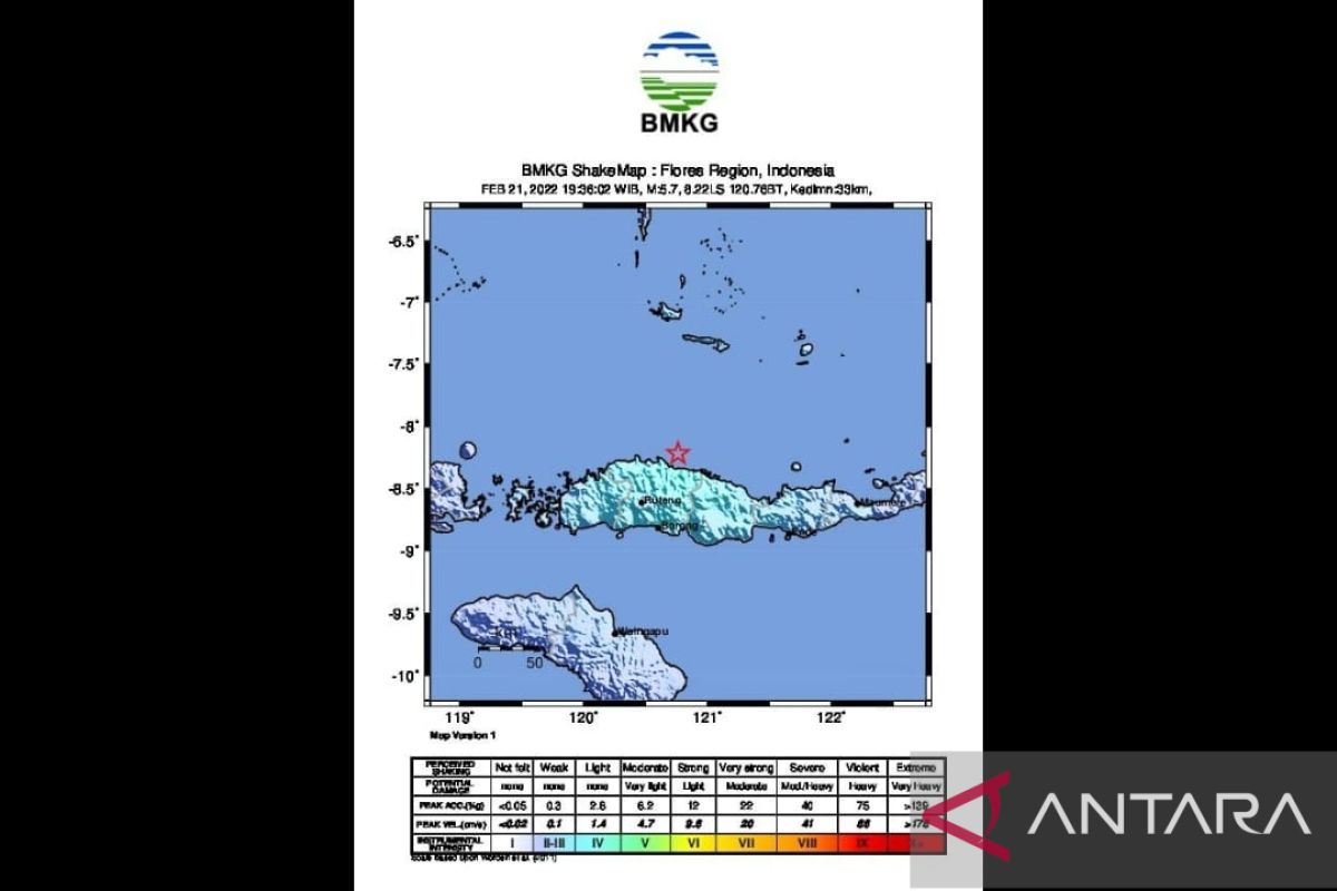
Manggarai was rattled by a 5.8-magnitude tectonic earthquake on Monday, February 21, at 19:35:59 local time. Its epicenter was located at 8.12 degrees South Latitude and 120.70 degrees East Longitude. The exact location was at sea, some 54 km northeast of Ruteng, Manggarai, East Nusa Tenggara, at a depth of 33 km.
Related news: New house, new life for earthquake victims in Pombewe
The earthquake was categorized as a shallow quake due to the Flores back arc thrust activity, as factors, comprising the location of the epicenter and the hypocenter depth, were taken into account.
The results of the analysis of the source mechanism show that the earthquake has a thrust fault mechanism.
Related news: Preparing disaster-resilient community in earthquake-prone Indonesia
The earthquake's impacts were felt in Labuan Bajo, Maumere, Ende, Soa, and Ruteng and was rated III on the MMI intensity scale. It also rocked Waingapu and Dompu at the MMI II-III intensity scale. The modeling results show that the earthquake has no potential to trigger a tsunami.
The strong earthquake that hit Manggarai posed no risk of damage.
Daryono noted that Manggarai on Flores Island was an area on which no large tsunami-inducing earthquakes had occurred in East Nusa Tenggara since the 1800s.
Related news: Ministry striving to improve local soybean product standardization
Related news: Jakarta remains at level 3 PPKM with less COVID-19 testing
Translator: Desi P, Mecca Yumna
Editor: Fardah Assegaf
Copyright © ANTARA 2022
