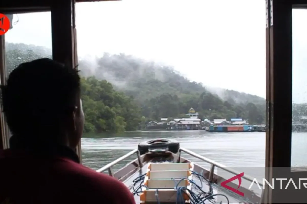
If you see the tip of dead trees in the middle of the dam, it is almost certain that down below used to be a village. But I cannot memorize all the names (of the villages)Banjarmasin, S Kalimantan (ANTARA) - Aunul Khoir, the head of Belangian Village, urged passengers of the traditional river boat klotok to have a moment to pray in front of a tomb that is considered sacred by local residents.
Unlike the general practice in a grave visit, this moment of prayer was conducted aboard the boat, in the middle of Riam Kanan Dam in Aranio Sub-district, Banjar District, South Kalimantan.
It is the grave of Nawiyah, a Banjarese religious figure, who fled from the Dutch colonial intimidation in 1800. The tombstone is no longer visible, as it now lays some 60 meters deep at the bottom of the dam.
The tomb is marked by four small wooden pillars surrounded by a plastic rope to form a rectangle.
Some flower garlands that has already dried up were seen tied to the plastic string.
Nawiyah's tomb was submerged as nine villages in Aranio District were drowned to the creation of the hydroelectric dam.
Development of the water reservoir that dams eight rivers in the Meratus Mountains area was started in 1958, and it was inaugurated in 1973 by then President Soeharto.
The 9,730-hectare reservoir was used as a Hydroelectric Power Plant (PLTA) for supplying electricity in several areas in South Kalimantan.
Residents of Belangian Village earlier resided in Kalaan Village, one of the villages that were flooded to build the reservoir.
Related news: UNESCO team reviews Meratus Geopark for UGGp status
"Our village used to be located on the banks of Kalaan River. The width of the river is about 30 meters," Hasriani, a Balangian resident, stated.
Hasriani, who is a descendant of the Dayak tribe, was born in Kalaan Village before it was submerged in the waters of the reservoir.
In the past, he said, Kalaan residents worked as farmers and gold and diamond miners.
After moving to Belangian Village, they are no longer miners but still work as farmers.
Aunul Khoir said, there were many unpleasant memories related to the construction of the dam, as villagers lost their livelihood, and compensation for them remained uncertain.
"I only heard these stories from my father, neighbors, and elderly people in the village," Khoir said, adding that he would also share it with the children.
However, life still goes on. They began to develop the tourism sector by making the most of the existence of Kahung forest.
Kahung is a protected tropical rain forest that is popular among adventurers.
Belangian Village, with a population of 350 people, has become a tourism village since 2018.
Usually, tourists come to this village to explore the Kahung tropical rain forest for its position as the gateway to Kahung.
Kahung Valley is one of the leading tourist destinations in South Kalimantan and is part of the Meratus Geopark area.
To enter this forest, visitors can walk from Belangian Village into the forest or take an ojek (motorcycle taxi) until the edge of the forest passing a narrow conblock path.
In the forest, visitors can enjoy the Kahung Valley waterfall. The forest is home to wild animals, such as long-tailed monkeys, honey bears, various types of birds, as well as various kinds of forest orchids and other rare plants.
Residents, apart from being farmers, also provide their houses for homestays for tourists.
Related news: Saving Meratus Mountains with geopark concept
According to Khoir, the average number of tourists visiting his village reached 100 per month.
Realizing the importance of the existence of Kahung Forest, he said, the villagers have built self-awareness to preserve the forest.
However, despite all these developments, the villagers have never forgotten the memories of their former village.
Khoir promptly nodded his head when asked to show the position of Kalaan Village before it was drowned.
"It is not far from here, about half an hour using a klotok," he stated.
Although Khoir is not a native of Kalaan Village, he had heard a lot about the past stories of the village from neighbors, village elders, and his parents.
"If you see the tip of dead trees in the middle of the dam, it is almost certain that down below used to be a village. But I cannot memorize all the names (of the villages)," he said.
When the dam's water level drops, he said, people can see more tips of dead trees from the former rubber plantation.
Related news: Proposal file streamlined for UGG tag for 11 world-class geosites
Respect the memory
Secretary General of the Global Geopark Network (GGN) Guy Martini, who visited the Belangian Village recently, said memories related to the ancestors' village would be interesting information for the visitors.
Moreover, it takes about two hours by klotok from the Tiwingan Village pier to reach the village that is located in the upstream of the Riam Kanan Dam.
During that two-hour journey, there should be some marked spots, where visitors can stop and get information about the spot, Guy stated.
"Here, we should find the soul of a geopark. (It is) because a geopark is not only about geology, but it also closely related to the biodiversity of the site, its culture, and all the stories of the ancestors," he remarked.
The involvement of local people will raise their pride, while for tourism operators, this information becomes something valuable to share and attract tourists, the Chairman of the UNESCO Global Geopark (UGGp) Council said.
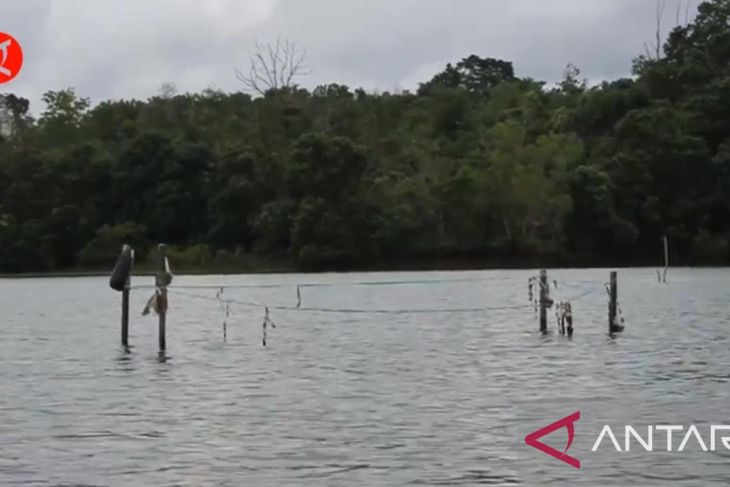
He noted that there are at least four sites and 15 stop spots in the Riam Kanan area for visitors to obtain interesting information.
During the trip to Belangian Village, Guy stopped at several spots, such as Deer Island that is planned to be a deer sanctuary, Bekantan Island for proboscis monkey conservation, Pine Island that has attracted local tourists for its “instagrammable” views, as well as Siran Island that has an archaeological site in the form of a stone axe.
Related news: Meratus dossier for UGG should be submitted by November: KNIU
This archaeological site can be seen clearly when the water level of the dam recedes.
Guy also briefly stopped at Nawiyah’s sacred tomb and had a moment of silence along with Aunul. He also stopped to look at a large dead tree in the middle of the dam that carried a small green plate on its branch with one red dot. There was a writing on the plate that says “Friday, 15 January. Flood. 2021.”
Apparently, the tree and the plate were used as a marker for the water level when a big flood hit South Kalimantan in mid-January 2021. It was the worst flooding ever to have hit the province that inundated 11 of the 13 districts and cities for more than two weeks.
This memory will never be forgotten by the people of South Kalimantan.
Related news: Oldest coal mine in South Kalimantan to become geotourism site
Related news: Curiak Island special site within Meratus Geopark area: GGN
Editor: Fardah Assegaf
Copyright © ANTARA 2022


