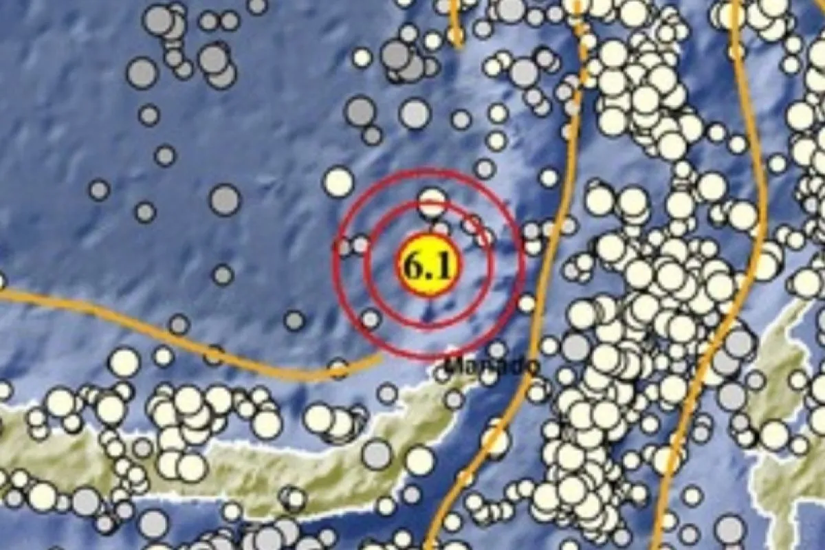
The epicenter of the earthquake, which struck at 07.30 WIB (West Indonesia Standard Time), was located at sea, about 69 kilometers southwest of Ondong at a depth of 255 kilometers, the agency stated in a press statement.
The tremor was felt by people in North Morotai at Modified Mercalli Intensity (MMI) scale III and Ternate at MMI scale II .
An earthquake of MMI II was felt by some people and resulted in the hung light articles shaking, while an eartthquake of MMI III could be felt indoors akin to the movement of a truck..
No immediate report was received of casualties or injuries.
Indonesia lies on the Ring of Fire along the north-eastern islands adjacent of New Guinea and the Alpide belt along the south and west from Sumatra, Java, Bali, Flores, and Timor.
The motion of the fault generates numerous small earthquakes on a daily basis.
Related news: West Bandung falls in medium earthquake-prone area category: PVMBG
Related news: 4.8-magnitude earthquake hits West Papua's Pegunungan Arfak
Related news: Sunday's quake damages four houses in Banten's Lebak District: Police
Translator: Andi Firdaus, Suharto
Editor: Sri Haryati
Copyright © ANTARA 2022


