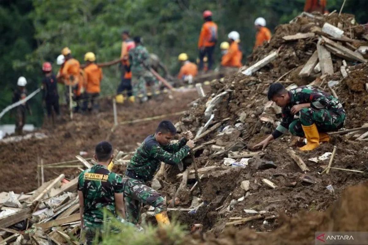
When disasters strike, central governments have a very important role in helping citizens recover from them.
This requires coordination between ministries, agencies, local governments, and a number of related parties.
Each country has a different way of handling disasters. Indonesia, on its part, has a national disaster mitigation system, which is regulated by Law No. 24 of 2007.
The government has also outlined various ways and efforts to reduce the impact of disasters.
At the national level, Social Affairs Minister Tri Rismaharini has emphasized the need for other disaster mitigation efforts, such as preparing evacuation routes, refugee camps, and relocation plans.
In the meantime, Coordinating Minister for Human Development and Culture, Muhadjir Effendy, has said that the government has been discussing rehabilitation and reconstruction efforts following the Banten quake.
Meanwhile, at the regional level, Lebak BPBD and other regions have continued to optimize socialization and mitigation education so that people can save themselves in the event of a natural disaster, he noted. They are also building evacuation routes around the coast for rescue efforts, he said.
The Meteorology, Climatology, and Geophysics Agency (BMKG) has asked the West Pasaman district government in West Sumatra to revise its regional spatial layout as part of mitigation efforts following the discovery of a new fault.
According to BMKG head Dwikorita Karnawati, after BMKG conducted research, it found a new fault, so spatial adjustments need to be made because the area was previously considered safe. She informed that the Talamau fault in West Pasaman was identified based on the results of a study. Hence, that area needs to be monitored as it is included in the red zone according to the new mapping results, she said.
According to the BMKG, the 6.1-magnitude earthquake in West Pasaman was followed by 161 aftershocks.
Meanwhile, the Ambon City Regional Disaster Mitigation Office (BPBD) conducted simulations for the mitigation of hydrometeorological disasters, such as floods and landslides, at Wai Batu Merah and Wai Tomu Rivers.
The simulation involved volunteers, Disaster Preparedness Cadets (Tagana), Indonesian Red Cross (PMI), and the residents of Negeri Batu Merah village, Ambon. Acting Mayor of Ambon, Bodewin Wattimena, urged people to not build houses in disaster-prone areas, such as riverbanks, mountain slopes, and hillsides.
In addition to holding disaster mitigation simulations, the Ambon BPBD has continued to strengthen human resources and improve procedures, regulations, and coordination for tackling the impact of disasters.
In the meantime, head of the National Disaster Mitigation Agency (BNPB), Suharyanto, urged regional authorities to prepare the relevant apparatus amid forecasts of extreme weather, which could disrupt residents' activities.
Emergency status response is essential to ensure that the relevant stakeholders can focus on assisting affected residents, reducing disaster risks to human lives, and preventing loss of life, he explained. Disaster mitigation is a joint effort between various stakeholders, hence there is a constant need to synergize and ensure proper coordination between agencies, he noted.
BPBD leadership in regions must take the initiative to encourage the relevant stakeholders to monitor precipitation conditions, prepare evacuation routes and places, and enhance the early warning system with the help of the police and the military, the agency head added.
According to Regional Representative Council (DPD) Speaker A. A. La Nyalla Mahmud Mattalitti, the curriculums of schools, especially those located in disaster-prone regions, must cover disasters. A disaster curriculum can become a foundation for children to protect themselves and help other people in case of disaster, he explained.
Disaster education should be initiated at an early age and should be long-term because that will build knowledge that can be applied until adulthood, he said. Schools can also involve nature-loving university students and trained experts to serve as teachers, he advised.
BNPB also invited various parties to plant mangroves on Soge Beach, Pacitan district, East Java province, as part of an effort to minimize the impact of a potential tsunami in the area.
General secretary of BNPB, Lilik Kurniawan, said the effort aimed to build a tsunami-resilient village. The mangrove planting activity was held to strengthen the disaster resilient-village program, which has been implemented in Sidomulyo village, Ngadirejo sub-district, Pacitan district, he said.
Mangroves can serve as natural barriers on beaches to break tsunami waves, he noted. In addition, they can be used to prevent abrasion.
Further, the BNPB is focusing on developing a people-centered early warning system to boost its effectiveness and strengthen public response. BNPB's early warning director Afril Rosya said that the disaster early warning system has two components: structural and cultural.
In addition, he outlined four sub-components of the early warning system. The first concerns the people's knowledge or ways to improve knowledge and risk perception among the people.
The second component involves monitoring and analysis. The third relates to ways to strengthen the dissemination of warnings to people and methods to communicate the results of monitoring and analysis to the people.
Meanwhile, the fourth component is response strengthening. According to Rosya, these four components made up the people-centered early warning system.
Meanwhile, BNPB has informed that an earthquake-resistant house will be built in Cianjur district, West Java, which quake survivors could replicate when rebuilding their homes.
The model house will be replicated by the recipients of Rp50 million in government assistance whose homes were heavily damaged in the 5.6-magnitude quake in November, BNPB head Suharyanto said.
The design of the earthquake-resistant house has undergone various tests, he added. The earthquake-resistant model house, which will be built by the BNPB, will be similar to those constructed in Pandeglang district, Banten province, which was rattled by quakes in 2018 and 2021, he said.
On the same occasion, head of BMKG, Karnawati, said that her agency will continue to disseminate information to the public regarding earthquake mitigation.
Using technology to mitigate disasters
The National Research and Innovation Agency (BRIN) is using image data obtained from its remote sensing satellite for various purposes, including the mitigation of disasters, such as forest fires and floods.
Head of BRIN, Laksana Tri Handoko, said the image data has become the basis for the creation of maps and spatial plans, mitigation of disasters such as forest fires and floods, and protection of Indonesia’s territorial sovereignty.
BRIN is developing and utilizing the remote sensing satellite to monitor the planet, including hotspots for anticipating forest and land fires, he noted. The satellite is also being used to detect disaster-prone environments and predict or detect dry land.
Meanwhile, Brawijaya University has developed an Internet of Things (IoT) technology based on the Geographic Information System (GIS) to mitigate disasters in Pronojiwo district, an area affected by the eruption of Mount Semeru.
Lecturer of urban planning at the university’s Faculty of Engineering, Adipandang Yudono, said the data generated by IoT can be crucial for dealing with disaster-affected areas.
After the Semeru eruption some time ago, the IoT technology was used to enter a number of data regarding the number of refugees, logistics, the distribution of survivors, the location of the post, medicines, and food, among others, he informed.
According to Yudono, during the recovery period, the GIS-based IoT technology has been used to map the condition of agriculture, livestock, as well as damaged schools in affected areas.
The operational dashboard contains infographics on the distribution of activities, the number of activities, and their graphs. Meanwhile, electronically, the IoT inputs data based on electronic sensors installed somewhere.
In the future, the geospatial-based IoT could be used for planning activities for the recovery of areas affected by the Semeru eruption, such as reforestation, he said.
Related news: Disaster mitigation plays crucial role in disaster management
Related news: RI includes livestock evacuation in disaster management measures
Related news: Knowledge management needed to build disaster resilience: BNPB
Editor: Azis Kurmala
Copyright © ANTARA 2022
