Muhari reported that the earthquake, which was earlier reported to have a magnitude of 7.3, was felt strongly, with a shaking duration of about 30 seconds.
The scale of the earthquake was felt from the 5th floor of the Mercure Hotel, Padang City, at Modified Mercalli Intensity (MMI) IV-V, with rattling walls, swaying lights, and items falling off from tables.
"People left their homes and panicked, but it was under control. Currently, some of them were evacuated away from the sea," Muhari noted in a statement received here, Tuesday.
As of 03:56 local time, Muhari reported that there were no abnormal conditions in the seawater.
"Visual limited monitoring shows no structural damage, while a detailed report is still awaited from the regional disaster mitigation agency (BPBD)," he noted.
Related news: BMKG records 10,792 earthquakes in Indonesia in 2022
In addition, the Meteorology, Climatology, and Geophysics Agency (BMKG) reported a tsunami to have been triggered from the earthquake with a height of 11 centimeters on Tuesday morning.
"A tsunami was observed with a height of 11 centimeters, from tide gauge data from Tanah Bala Station, South Nias," Head of the BMKG Earthquake and Tsunami Center, Daryono, stated in Jakarta.
He also noted that the earthquake was a megathrust event.
The earthquake was felt in Siberut, Mentawai, at MMI VI; Pasaman Barat, Padang Pariaman, Agam, and Padang at MMI V; Gunung Sitoli, Padang Panjang, South Pesisir, Lima Puluh Kota, South Solok, Solok, Bukittinggi, and Padang Sidempuan at MMI III; and Labuhan Batu Bengkalis at MMI II.
The BMKG issued a tsunami early warning for North Sumatra after the earthquake struck on Tuesday morning at 3:00 local time.
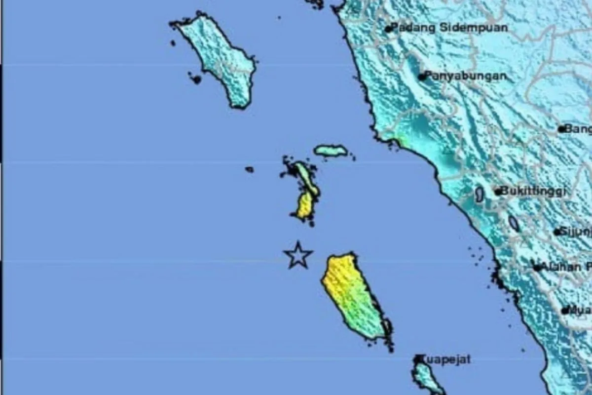
The epicenter of the earthquake was located at 0.93 degrees South Latitude, 98.39 degrees East Longitude, 177 kilometers northwest of Mentawai Islands, West Sumatra, at a depth of 84 kilometers.
The BMKG warns the community to be vigilant, especially for those staying at the Tanabala Island area, South Nias District, North Sumatra, since the wave arrival times may vary, and the first wave may not be the biggest.
Related news: Ministry unveils Indonesia earthquake hazard deaggregation map book
Translator: Devi Nindy Sari R, Resinta S
Editor: Yuni Arisandy Sinaga
Copyright © ANTARA 2023


