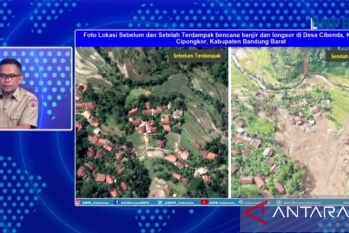
Head of the BNPB Data, Information, and Communication Center Abdul Muhari stated here on Thursday that based on the satellite image and drone visualization, some parts of forests atop Cibenda Hill, Cipongkor, had been converted into agricultural land and rice fields.
Furthermore, he noted that horticultural plants were found to grow in the lush forest vegetation on the southwest and northeast sides of Cibenda hills.
"The change resulted in the loss of vegetation that plays an important role in maintaining soil stability. When the rainwater hits the ground, a landslide occurs and buries the residential areas right under the hill," he explained.
Muhari emphasized that the conversion of forests into agricultural land is not completely prohibited, but it must be carried out through careful consideration and technical engineering to prevent disasters.
Meanwhile, BNPB's analysis found that the traditional terracing system was applied in rice fields in the landslide-affected areas to prevent soil erosion. This system is found in rice fields across Indonesia.
He stated that for the long-term plan, people need to be relocated to safer places, and natural or artificial engineering should be conducted to protect the ground during high rainfall.
The landslide in Cibenda Village damaged at least 30 houses, two places of worship, and two educational facilities, as well as caused heavy damage to 71 houses in Rongga Village.
Until Thursday morning, 1,610 residents had been displaced, comprising 527 in Cipongkor and 1,083 in Rongga.
Related news: W Java: Residents near landslide-hit area urged to move
Related news: At least nine missing in West Bandung flash flood, landslide: BNPB
Translator: M Prasetyo, Kenzu
Editor: Azis Kurmala
Copyright © ANTARA 2024


