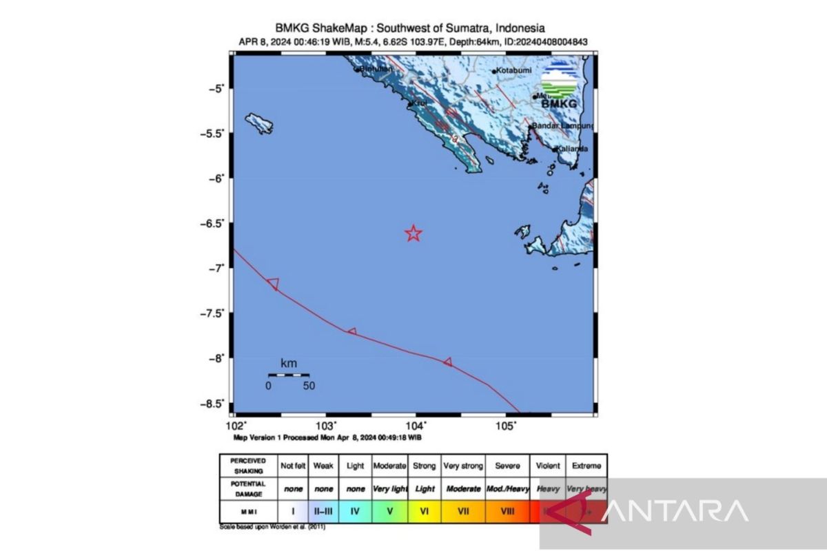
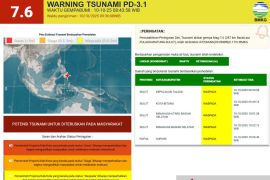
The epicenter of the quake that occurred at 00:46 a.m. local time was located about 149 km away from southwest of Tanggamus at a depth of 64 km, the Meteorology, Climatology and Geophysics Agency (BMKG) reported.
According to the agency, the quake tremors were felt by several residents in Tenggamus and several other areas, including Krui in Pesisir Barat District, and Tanjung Karang in Bandarlampung City.
BMKG urged locals in the affected areas to remain alert and get updated by accessing its official social media platforms.
Earthquakes are a regular occurrence in several parts of Indonesia since the country lies on the Circum-Pacific Belt, also known as the Ring of Fire, where several tectonic plates meet and cause frequent volcanic and seismic activities.
On December 26, 2004, for instance, Aceh, the country's westernmost province, experienced the deadliest earthquake ever on record. The quake had a magnitude of 9.3 and was followed by a tsunami.
The catastrophe, which also affected certain coastal areas in countries such as Thailand, Sri Lanka, and India, reportedly killed at least 230 thousand people in Aceh.
Fourteen years later, Indonesia again bore witness to another deadly earthquake as several parts of Central Sulawesi Province were jolted by a powerful quake with a magnitude of 7.4 on September 28, 2018.
The strong earthquake that was followed by a tsunami and soil liquefaction in Palu, the capital of Central Sulawesi Province, claimed 2,102 lives, injured 4,612 and rendered 680 others missing.
A total of 68,451 homes incurred serious damage, while 78,994 people were displaced.
The authorities and humanitarian workers decided to bury a large number of rotting corpses in mass graves.
Meanwhile, material losses inflicted by the twin deadly disasters were estimated to reach Rp15.29 trillion.
Palu City bore the brunt of the disaster, with material damage and losses recorded at Rp7.6 trillion, or 50 percent of the total estimate, according to the National Disaster Mitigation Agency (BNPB).
The material damage and losses in Sigi District were recorded at Rp4.9 trillion, or 32.1 percent; Donggala District, at Rp2.1 trillion, or 13.8 percent; and Parigi Moutong District, at Rp631 billion, or 4.1 percent.
Material damage in the four affected areas reached an estimated Rp13.27 trillion, while material losses were reportedly around Rp2.02 trillion, BNPB stated in October 2018.
Then, on January 15, 2021, a 6.2-magnitude earthquake also rattled the districts of Mamuju and Majene, West Sulawesi, claiming more than 100 lives and destroying several buildings.
Related news: Attorney General's Office sends food aid to disaster-hit regions
Related news: President officiates two post-tsunami rehabilitated ports in Palu Bay
Translator: M.Riezko BEP, Rahmad Nasution
Editor: Aditya Eko Sigit Wicaksono
Copyright © ANTARA 2024
