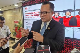
"Bathymetry can be interpreted as measuring and mapping the topography of the seabed. The benefit of a Bathymetry map is that it can directly evaluate deformation after a large underwater earthquake that caused a tsunami," he noted in a statement from BRIN in Jakarta, Wednesday.
Djajadihardja explained that Japan had implemented the bathymetric mapping approach, such as in predicting the tsunami disaster that hit the country on March 11, 2011.
"Japan was able to identify the cause of the tsunami immediately, and the day after the disaster, it announced a movement of 50 meters based on the initial comparative data," he stated.
In contrast, Djajadihardja pointed out that in the tsunami catastrophe that struck Aceh in 2004, Indonesia could not keep track of the tsunami propagation, as it lacked preliminary data.
In addition, the tsunami's effects were so wide-ranging that not only land but also the seabed's surface was affected, with muddy motions induced by the disaster.
"The anticipation of having data before and after a disaster shows the importance of bathymetry as a basis for information to be able to predict whether a disaster will occur," he stressed.
Djajadihardja also underscored the importance of Bathymetric maps for defense purposes in marine areas, as the sea can only be visualized with one's mind's eye.
"Bathymetric maps help Indonesia to know its water areas in detail, including sea depth, seabed shape, and the existence of various geomorphological features such as coral reefs, sea mounts, and sea trenches," he explained.
According to Djajadihardha, the benefits of Bathymetric maps are not only limited to the maritime sector but also extend to various other fields such as research, fisheries, industry, tourism, and natural disaster management.
"Bathymetric maps are valuable assets that must be used wisely to improve community welfare and preserve the sea for present and future generations," he remarked.
Djajadihardja expressed hope that Bathymetric maps can soon be implemented evenly across Indonesia since optimal utilization of this approach can help improve various factors such as safety, environmental sustainability, and community welfare.
Related news: LIPIi to conduct bathymetric mapping in Indian Ocean
Related news: Minister urges W Sumatra govt to make disaster mitigation top priority
Related news: BRIN to map faults, disaster risk in Java Island
Translator: Sean Filo Muhamad, Cindy Frishanti Octavia
Editor: Azis Kurmala
Copyright © ANTARA 2024
