Herman Yosef Mboro noted in a statement on Tuesday (July 8) that the ash column from the eruption reached approximately two thousand meters above the summit, or about 3,584 meters above sea level.
"The ash column was observed to be gray in color with thick intensity, leaning toward the west and northwest," Mboro remarked.
This eruption was recorded on a seismogram with a maximum amplitude of 14.8 mm and lasted about five minutes and 13 seconds.
Earlier that day, an eruption was also reported at 16:08 local time, with the ash column reaching around 1,200 meters above the summit, or approximately 2,784 meters above sea level.
Mount Lewotobi Laki-laki is currently at Alert Status Level IV. The public and visitors are advised to refrain from any activity within a six-kilometer radius and a seven-kilometer sector from southwest to northeast of the eruption epicenter.
The public is also urged to stay calm, follow local government instructions, and disregard rumors from unverified sources.
Related news: Ngurah Rai's flights resume Tuesday after Lewotobi eruption
Residents around the volcano should be cautious of potential cold lava floods in rivers originating from the summit of Mount Lewotobi Laki-laki, especially during heavy rain, particularly for villagers in Dulipali, Padang Pasir, Nobo, Nurabelen, Klatanlo, Hokeng Jaya, Boru, and Nawakote.
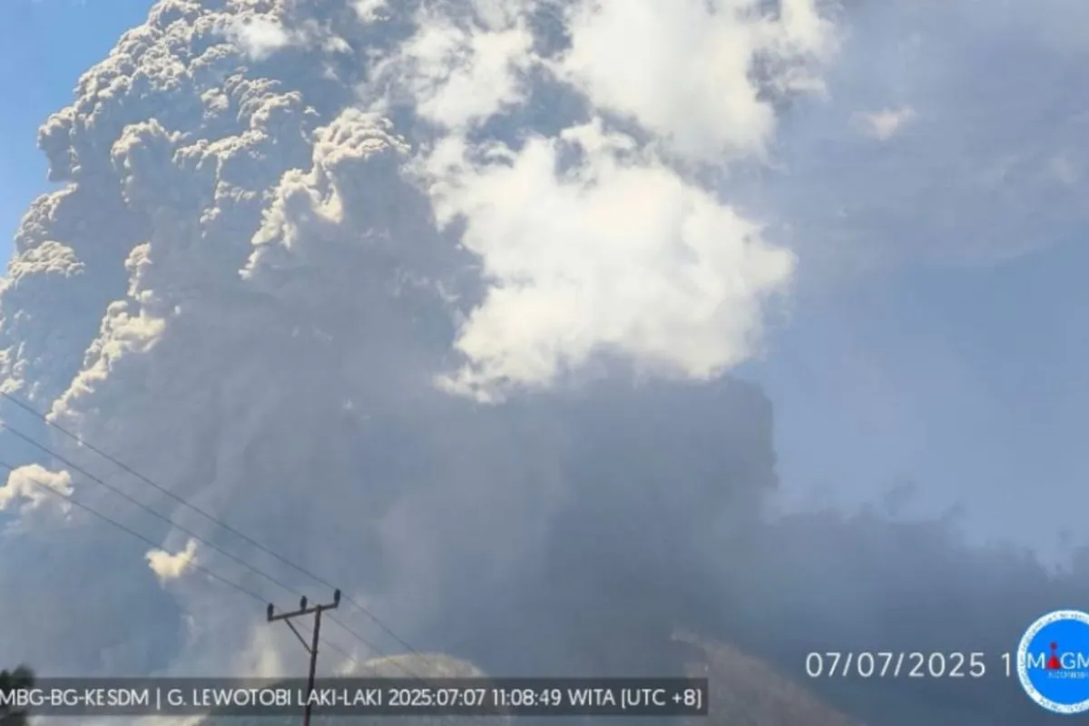
Earlier, on Monday (July 7), Mount Lewotobi Laki-laki erupted at 11:05 local time, sending a volcanic ash column as high as 18 thousand meters above the summit.
This incident disrupted flight activities at three nearby airports: Komodo Labuan Bajo Airport, El Tari Kupang Airport, and I Gusti Ngurah Rai Bali Airport.
Related news: Komodo Airport resumes flights after Mount Lewotobi eruption
Translator: Gecio Viana, Resinta Sulistiyandari
Editor: Rahmad Nasution
Copyright © ANTARA 2025