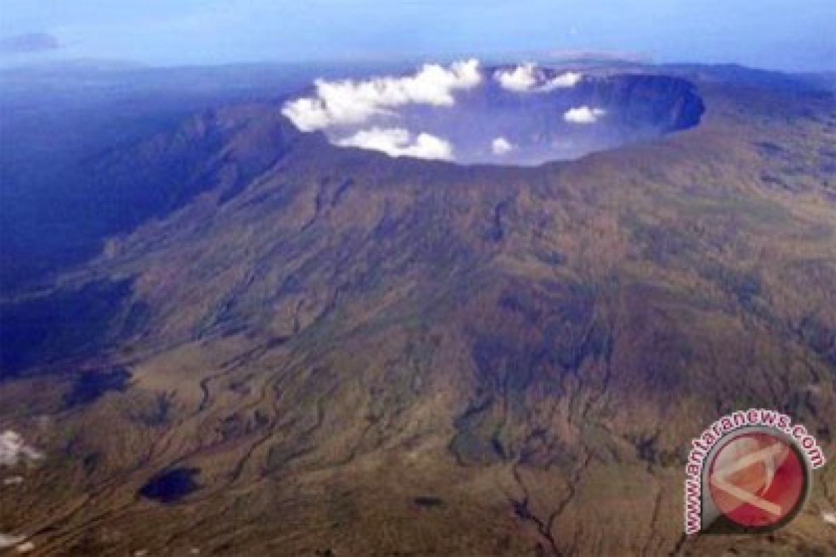
"The status remains, no change," the mineral and geology chief of the mining and energy office Muhammaddin said.
Visual monitoring and volcanic activities still continues to anticipate any factors that might increase the mount`s status in the future.
The volcanology and mitigation agency also categorized the most affected areas into three disaster-prone areas, namely prone area III (three kilometers radius from the crater), prone area II (five kilometers from the crater) and prone area I (eight kilometers).
Hot clouds, lava flow, toxic gas, hot rock avalanches and heavy ash rain are threatening prone area III.
Prone area II has been worsened with added threats of high water acidity and cold lava flow, while prone area I is facing a threat of lava, ash rain and stone avalanches.
Muhammaddin also said that people are living within the prone area, and the agency had also called on the people not to conduct any activities anywhere in the designated areas.
Mount Tambora`s status was heightened from Normal to Alert as of August 30, 2011, while on September 5 a blast crater 10 meters high was reported with white thin smoke gushing from the crater`s rim.
Besides visual observation an increase in seismic activity from 30 August to 6 September is also reported with 5-15 volcanic earthquakes, 1-7 shallow volcanic earthquakes, 1-4 local tectonic earthquakes, and 2-13 distant tectonic earthquakes.
Some 1-6 "low frequency" earthquakes were also reported accompanied by tremors with an amplitude of 0.5 to 9 millimeters (mostly one millimeter) each day.
On September 7, there was a significant increase in seismic activity mainly in volcanic earthquakes, and 32 incidents in just six hours, and shallow volcanic quakes which may increase in greater volcanic activity.
Based on the development, the Volcanology and Disaster Mitigation agency raised the status of Mount Tambora the next day from alert II to III.
Mount Tambora is a type-A volcano because it is still active since 1600, and located in Dompu and Bima district, West Nusa Tenggara province, and has a height of 2815 meters above sea level.
Mount Tambora was known in volcanic history for its mega eruption in 1815, which buried three Indonesian kingdoms namely Pekat, Tambora and Sanggar killing around 92 thousand people.
(U.A050/H-NG/A014/F001)
Editor: Priyambodo RH
Copyright © ANTARA 2011


