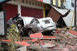
According to Meteorology Climatology and Geophysics Agency (BMKG), the epicenter of the earthquake was located 115km northwest of West Halmahera, 1.71 degree of Northern Latitude - 126.57 degree of Eastern Longitude at the depth of 10km.
The earthquake has no tsunami potential.
Head of Information and Data Center of National Disaster Mitigation Agency Sutopo Purwo Nugroho said here Wednesday that the earthquake was strongly felt in West Halmahera for five seconds.
"The earthquake was also felt by people of Ternate for three to five seconds. In fact, people in Manado too," Nugroho said.
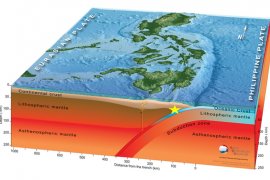
Nugroho said the earthquake was due to double subduction, a geodynamic process in which two plates following each other are synchronously subducted, between the Philippines Sea Plate on east and the Eurasia Plate on the west side on Maluku Sea Plate.
On November 11 2014, another major earthquake measuring 7.3 on the Richter Scale jolted the region triggering the tsunami early warning system.(*)
Editor: Heru Purwanto
Copyright © ANTARA 2015


