"The use of drones can save time, cost and the number of personnel deployed in the field, as well to minimize the risk," Sutopo said.Jakarta (ANTARA News) - The National Disaster Mitigation Agency (BNPB) continues its efforts to improve the disaster and humanitarian response by integrating drones or unmanned aerial vehicles (UAVs)
Head of Information and Data Center of BNPB Sutopo Purwo Nugroho, said here on Thursday that the UAVs are helping the agency map the disaster areas or identify the disaster potential that will enable a quick response and proper anticipation.
While so much of the news coverage about drones lately has focused on their negatives, such as interfering with air traffic, it turns out they have more positive application in the humanitarian sector.
"The use of drones can save time, cost and the number of personnel deployed in the field, as well to minimize the risk," Sutopo said.
The agency will cooperate with several drone enthusiasts or community members to integrate UAVs into the disaster response.
BNPB has been cooperating with the Geospatial Information Agency (BIG) and the Technology Assessment and Application Agency (BPPT) for analyzing data and mapping the disaster area.
However, Sutopo said the technology of UAVs has been developing fast and that its application for humanitarian disaster relief is pushing the boundaries of how aerial imagery technology, with GPS and high resolution images, can reshape the ability to respond to disasters rapidly.
Meanwhile, the Deputy of Emergency Response at BNPB Tri Budiarto said the collaboration between the agency and the drone community will be essential for BNPBs disaster response and humanitarian relief.
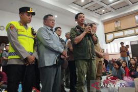
The agency on Thursday conducted a seminar with drone enthusiasts and communities to discuss the UAVs integration in the humanitarian relief.
Tri expects that the drones would not only be used for disaster mapping, but also for a real-time analysis of disaster mitigation.(*)
Editor: Heru Purwanto
Copyright © ANTARA 2016
