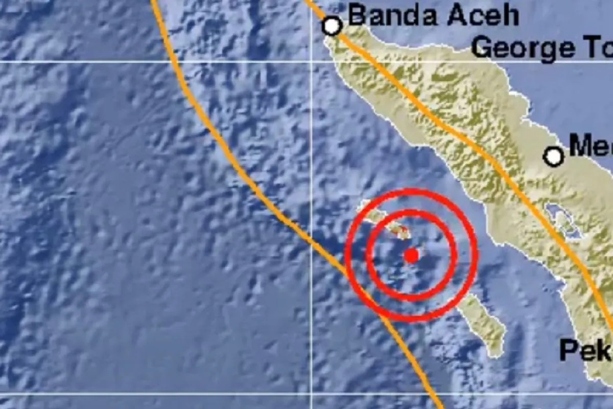
According to the Meteorology, Climatology, and Geophysics Agency (BMKG), the earthquake epicenter was roughly 44 kilometers southeast of Sinabang, and at a depth of 21 km.
Aceh Province is one of the areas in Indonesia that are susceptible to natural disasters, such as earthquake, tsunami, and flooding. In 2004, Banda Aceh and several other parts of Aceh Province were rattled by a deadly tsunami following a powerful earthquake.
Located on the Circum-Pacific Belt, also known as the Ring of Fire, where several tectonic plates meet and cause frequent volcanic and seismic activities. Indonesia is susceptible to natural disasters, including earthquakes and volcanic eruptions.
During 2018, the Meteorology, Climatology, and Geophysics Agency (BMKG) recorded that Indonesia had borne the impact of 11,577 earthquakes, including several causing grave casualties, with the number significantly rising than that in 2017.
The BMKG data showed that 11,577 earthquakes, with varying magnitudes and depths, hit during 2018, while just 7,172 earthquakes were recorded in 2017.
This indicates that Indonesia bore witness to a significant increase in the number of tectonic earthquakes last year.
Several earthquake-related events that had struck Indonesia last year were first of a kind to have occurred, such as the liquefaction in Palu, a tsunami that struck prior to the issuance of a tsunami warning in Palu, and the Sunda Strait Tsunami.
Related news: Death toll of Banten's earthquake has climbed to six
Related news: Indonesians told to ignore 9-magnitude earthquake rumors: BMKG
Translator: Aditya R, Rahmad Nasution
Editor: Fardah Assegaf
Copyright © ANTARA 2019


