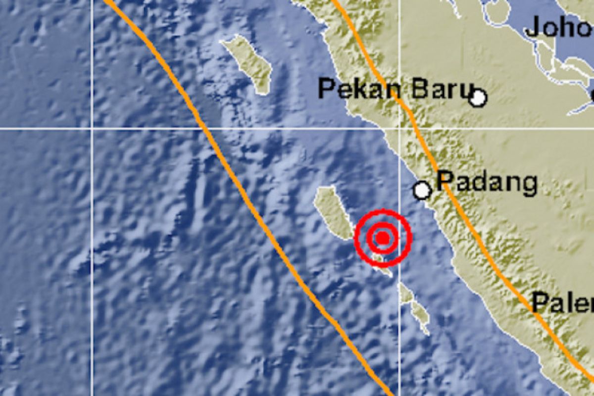
The 5.6- and 5.7-magnitude earthquakes occurred at 2.31 p.m. and 2.47 p.m. local time, and the tremors could be felt in several parts of West Sumatra and Bengkulu provinces, including Padang, Painan, Mentawai, Mukomuko, and Bengkulu.
However, the earthquakes — whose epicenters were located around 33 km southwest of Pagai Selatan Island — did not trigger any tsunami, head of the Earthquake and Tsunami Center of the Meteorology, Climatology, and Geophysics Agency (BMKG), Rahmat Triyono, said.
“Looking at their epicenters and depths, they are shallow earthquakes owing to subduction in the Pagai Selatan Plate of Mentawai Islands. The source-mechanism analysis reveals that the earthquakes have thrust fault movements," he informed.
Early on Sunday, a 5.3-magnitude earthquake had rocked southwest of Mukomuko district, Bengkulu province.
The epicenter of the quake, which occurred at 00.55 a.m. local time, was located around 125 km southwest of Mukomuko district at a depth of 27 kilometers, BMKG revealed.
Both West Sumatra and Bengkulu are prone to earthquakes and tsunamis. Several other provinces situated in the northern parts of Sumatra Island are also vulnerable to such disasters.
Related news: Earthquake jolts Mentawai Islands
Related news: Magnitude 5.2 quake jolts Mentawai islands
Related news: Earthquake jolts Mentawai, Sumatra
According to the Deli Serdang Meteorology, Climatology, and Geophysics Agency (BMKG) in North Sumatra province, 156 earthquakes have rocked the northern parts of Sumatra Island between September 25 and October 1, 2020.
On September 30, for instance, earthquakes jolted the districts of Aceh Barat Daya, Nagan Raya, Bener Meriah, and Aceh Jaya in Aceh province.
Earthquakes regularly strike various parts of Indonesia due to the fact that the country lies on the Circum-Pacific Belt, also known as the Ring of Fire, where several tectonic plates meet and cause frequent volcanic and seismic activity.
One of the deadliest earthquakes recorded in Indonesia in the past two years was the one that struck several parts of Central Sulawesi province.
The 7.4-magnitude earthquake, which was followed by a tsunami, that struck Palu city and the districts of Donggala, Paringi Moutong, and Sigi on September 28, 2018, claimed 2,102 lives, injured 4,612, and rendered 680 others missing.
A total of 68,451 homes were seriously damaged, and 78,994 people were displaced in its wake.
Given the large number of rotting corpses, the authorities and humanitarian workers had to decide in favor of burying them in mass graves.
Meanwhile, material losses inflicted by the twin disasters were estimated to be Rp15.29 trillion.
The provincial capital of Palu bore the brunt of the disasters, with material damage and losses recorded at Rp7.6 trillion, or 50 percent of the total estimate, according to the National Disaster Mitigation Agency (BNPB).
The material damage and losses in Sigi district were pegged at Rp4.9 trillion, or 32.1 percent of the total estimate; Donggala district at Rp2.1 trillion, or 13.8 percent; and Parigi Moutong district at Rp631 billion, or 4.1 percent.
The material damage in the four affected areas reached an estimated Rp13.27 trillion, while the material losses were reported to be in the range of Rp2.02 trillion, the agency revealed in October, 2018.
Related news: Four earthquakes of varying magnitudes jolt Indonesia on Tuesday
Related news: Indonesia hit by 11,577 earthquakes in 2018
Related news: NEC completes construction of earthquake detection system in Indonesia
Translator: Desi P, Rahmad Nasution
Editor: Yuni Arisandy Sinaga
Copyright © ANTARA 2020


