Disaster mitigation programs must have a basis and be in line with science and researchJakarta (ANTARA) - The Indonesian Tsunami Early Warning System (INA-TEWS) needs to be adapted to the character of earthquakes and tsunamis as well as the very varied geographical conditions of regions, a researcher has said.
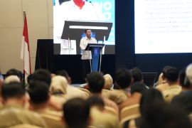
"TEWS design must be detailed and specific to each region. An effective TEWS must have a technological design based on scientific studies," said Danny Hilman Natawidjaja, a research professor from the Indonesian Institute of Sciences (LIPI), while reading a paper on 'Research on Indonesian Active Faults and Its Role in Earthquake and Tsunami Disaster Mitigation', here on Tuesday.
Just like a seismic hazard map, a tsunami hazard map needs to be drawn for tsunamis caused by the movement of faults under the sea, Natawidjaja added.
A tsunami hazard map is needed to facilitate evacuation routes under the early warning system and for tsunami mitigation through spatial management and construction design that is resistant to tsunami shocks, he said.
"Without adequate knowledge of active faults under the sea, a tsunami hazard map cannot be made properly," said the geoscience researcher.
In addition, disaster mitigation requires the best possible knowledge of the characteristics and potential of the natural disaster source itself, he pointed out. So, mitigation must be complemented by basic research and applied research, such as making hazard and risk maps, he explained.
"Disaster mitigation programs must have a basis and be in line with science and research," said Natawidjaja.
He said he has carried out active fault research on earthquake sources since the early 90s in Sumatra, then in Java, Nusa Tenggara, Sulawesi, Papua, and Maluku.
The research has shown that almost all parts of Indonesia are threatened by earthquakes and tsunamis, he informed. The research has also shown that the characteristics and potential hazards of active fault systems of earthquake sources in Indonesia differ from one region to another, he added.
Related news: BNPB records 1,560 natural disasters during Jan 1-July 15 period
Hence, the character and potential sources of earthquakes and tsunamis that are specific to each region require handling of disaster mitigation with a specific design, according to the conditions of the disaster source, he pointed out.
Such handling would include the design of disaster education materials for the community, the design of programs to prepare resilient communities, and also the design of a monitoring system for early warning, he said. It is a mitigation concept based on science and research, he remarked.
"In an integrated mitigation effort, disaster research and education must be a priority," Natawidjaja added.
He said that earthquake source data based on the results of active fault research had been used to create seismic hazard maps of Indonesia, which were published by the Ministry of Public Works and Public Housing in 2010 and 2017.
Related news: Obtain updates on disasters, risk alerts from reliable sources: BNPB
The maps were then used to make the Indonesian National Standard (SNI) for Earthquake Resistant Construction Regulations, he said.
"It is SNI 1726-2012, and the last is SNI 1726-2019," he informed.
However, the standards do not cover the mitigation of hazards caused by movements along fault lines and associated hazards, he said.
Related news: Domestic travelers' vaccine card mandated in level 3, 4 areas
Related news: Impacts of climate change, COVID-19 projected to be same: Indrawati
Translator: Martha Herlinawati Simanjuntak
Editor: Fardah Assegaf
Copyright © ANTARA 2021
