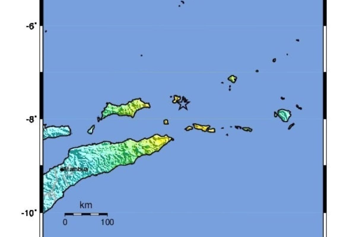
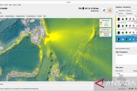
This intraplate earthquake produces a stronger ground motion, so it is natural for this earthquake to be felt at long distances up to Sorong City in West PapuaJakarta (ANTARA) - A strong 7.4-magnitude earthquake registered on Thursday at 01:25:53 a.m., 132 kilometers east of Tiakur, Southwest Maluku, indicates that the source of the quake of medium depth that hit Banda Sea is still very active.
The earthquake, whose magnitude was updated to 7.3 and struck in the sea with a hypocenter depth of 183 km, is an intermediate-depth quake due to the deformation of rock during the subduction of tectonic plates and hence called an intraplate earthquake.
"The earthquake of medium depth in the Banda Sea is still very active and can trigger a strong earthquake," Daryono, coordinator for Earthquake and Tsunami Mitigation at the Meteorology, Climatology and Geophysics Agency (BMKG), stated here on Thursday.
Related news: BMKG records 27 earthquakes in Aceh-North Sumatra on December 17-23
The earthquake had a thrust fault mechanism due to strong pressure from within the subducted tectonic plates.
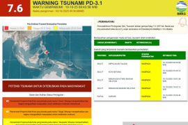
The results of sea level monitoring conducted immediately using the Tide Gauge did not show a rise in sea levels around the epicenter, thereby indicating that there was no tsunami.
"This earthquake has no potential to trigger a tsunami, as the hypocenter is relatively deep (183 km). Hence, rock deformation does not disturb the seawater column," he explained.
The earthquake tremors were felt strongly in Tiakur on an intensity scale of MMI V-VI; in Tepa at MMI IV-V; in Saumlaki at MMI IV; and in Tual, Kupang, Alor, Rote, Malacca, Atambua, and Sumba at MMI III-IV. Meanwhile, the farthest shock from the earthquake was felt in Sorong City of West Papua.
"This intraplate earthquake produces a stronger ground motion, so it is natural for this earthquake to be felt at long distances up to Sorong City in West Papua," Daryono remarked.
Related news: BMKG records 75 aftershocks following Sorong's 5.3-magnitude quake
BMKG's monitoring until 5 a.m. local time showed 11 aftershocks, with the largest magnitude of the aftershock reaching 5.3 and the smallest magnitude of 3.9.
Meanwhile, the location of the earthquake source is seismically in a complex tectonic and seismically active area, which is a transition zone between the Eurasian continental crust and the Australian continental crust.
Several historical records show that tsunamis occurred near the epicenter in Banda Sea in 1673, 1710, and 1763.
In the meantime, several other significant earthquakes also struck in Kendari, Southeast Sulawesi, with a magnitude of 2.6 at 00:31:52 a.m. local time; in Tarakan, with a magnitude of 4.4 at 01:09:24 a.m. local time; and in Sukabumi, with a magnitude of 4.1 at 05:05:36 a.m. local time.
Related news: Indonesia receives 1.2 million COVID-19 vaccines under COVAX
Related news: Ministry aims to fully vaccinate 208 mln citizens by March 2022
Translator: Katriana
Editor: Fardah Assegaf
Copyright © ANTARA 2021
